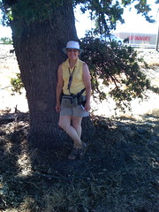
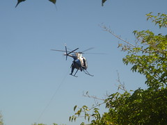
We were so close, we just had to make the trip north to Yreka to pick up a quad for Cynthia & Mike. Sure it was in the opposite direction, but what the hey, we were so close. We didn’t count on running into rain, but we did. Fortunately, it was just sprinkles and stopped as fast as it started--several times. The unfortunate part was that we looked for two caches without success before we actually found one! We did have a nice view of the reservoir while we searched for one.
On to quad 35! We headed down Hwy 3. We used to travel on the other end of 3 when my parents owned a house in Trinity Center. The trip brought back memories of the time we spent in Trinity. On our journey we passed through the town of Fort Jones. We were curious about whether a fort really existed here at some point so I checked it out on the internet. According to Wikipedia: “Ultimately, the town of Fort Jones takes its name from the frontier outpost once located less than a mile to the south. From the time of the earliest communal settlement, circa 1850, the town was referred to as Scottsburg, then Scottville, and in 1852 the townsite was named in honor of Mr. O. C. Wheelock who, with his partners, established the first commercial enterprise in the upstart village. In 1854 a post office was established in the town by the name of Ottitiewa, the Indian name for the Scott River branch of the Shasta tribe, and the name held for some six more years until 1860 when local citizens successfully petitioned the postal department to change the name to Fort Jones in honor of the nearby military outpost”.
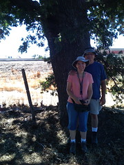
While on this drive we were also traveling through the Marble Mountain Range. According to the internet: “Established as a primitive area in 1931, the Marble Mountain area received Wilderness designation in 1953, establishing it as one of the earliest Wilderness areas in California. The area where the Marble Mountains now exist was once part of a the flat bottom of an ancient, shallow ocean. Millions of years ago, violent volcanic upheavings and the erosive cutting action of rivers and glaciers combined to form the Marble Mountains. Marble Mountain itself is composed primarily of prehistoric marine invertebrates. Almost all the lakes of the Marble Mountains were formed by ancient glacial activity. The colors of this wilderness area, from the majestic white of Marble Mountain, to the lush green of Morehouse Meadow, to the deep blue of Cliff Lake, interspersed with various hues of sheer rock cliffs and densely timbered mountainsides, provides a spectacle not soon to be forgotten”. It truly was a lovely drive. I think it was well worth the extra time it took! The views were spectacular! And, yes, we found the cache!

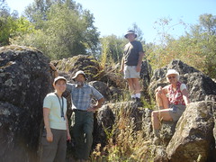
Based on the description of the cache, we were expecting to climb down the hill. The description included warnings about watching our steps and it was a long way down. Logs on the cache page talked about the way to the cache being slippery and precarious. We parked in a pull out along the side of the road. Larry & Mike actually headed up a step precarious slippery rocky slope while Cynthia & I remained below to summon help if necessary. When they got to the top, they discovered a parking area accessible from a road a little further up the road from where we parked the car. Cynthia and I got back in the car and drove up to the top to offer them a ride down. The cache was just a couple of feet down the slope from the parking area! I repeat: the views were spectacular.

Now we had to retrace our steps at least part way. When we left this cache, we were traveling on the Cecilville-Callahan Road. When we reached Callahan we “switched” to the Gazelle-Callahan Road. We traveled through the hills, through meadows, around some hairpin turns, and saw some beautiful sites. We traveled on Old Hwy 99 as we left the town of Gazelle behind and headed back to I-5. It was a beautiful time of the year to be traveling through this area.
Lunch was quite an experience. We spent a lot of time waiting. We ate at the Black Bear Restaurant in Mt. Shasta. That was our first mistake. Since it was Sunday, everyone in town plus all the travelers were eating at the Black Bear. We had to wait to be seated, we had to wait for our server, and we had to wait for our lunch--a long time. Once we were served, the food was good, but the whole process put us behind schedule. Mike said he would have to drive faster if we wanted to do everything we had hoped to do today! We didn’t argue with him.
We headed over to McCloud on Hwy 89 for a cache and a quad. There were two more close by (depending on your definition) a little further up the road so we kept going on 89. We stopped for a cache at a Mt. Shasta vista point. The mountain was partially covered with snow and presented a pretty picture. The issue was the the cloud cover that partially obscured the top of Mt. Shasta. With the right camera, it can still be spectacular but we had to settle for using our happy snap.
Now we were faced with the burning question: Do we continue on 89 to pick up another quad or do we return to I-5 and head for “home”? We asked our driver (Mike) his opinion and he basically said he didn’t care (my words, not his). Cynthia and I looked at each other and agreed that he was committing to the trip so we jointly gave the go ahead. Larry was eager to go along with our decision (my words, not his). It was only 30 miles away as the crow flies so off we went.

It’s a good thing we decided to go! We found ourselves right in the middle of a cattle drive! We just pulled over to the side of the road and watched the cows go by! They didn’t pay any attention to us while we snapped their pictures. We kept waiting for the cowboys on their horses, but all we saw were young ladies on their quadrunners driving along behind the cows. Those cows thought they owned the road and we weren’t going to argue! What fun! They did get a little close but three of us were in the car safe and sound. Mike took pictures from inside while Larry was outside taking pictures. Larry wasn’t worried--he raised cows in his youth and knew just how to handle them!
At the other end of the cattle drive we found the grounds of the Fort Crook Museum. There was an old jail (we avoided that location), a blacksmith’s shop, and miscellaneous other buildings with Indian artifacts. We wandered around a bit but ultimately ended our exploration when standing over the cache we had been seeking. Once we signed the log we headed west on 299 and passed the Pit River Power House. Cynthia and I used to fish near the Power House when we were little. Our father would come to this area on business and fishing was our entertainment while he took care of business. This has definitely been a trip of memories for the two of us.

It has also been a trip of different textures, colors, experiences, views, and fun! There was so much to see and enjoy no matter where we were! We traveled at a more leisurely pace today (don’t ask Mike if he agrees) but we managed to take in a lot of territory and adventures to add to the previous days experiences. The four of us were born and raised in California and have been to many of these places before. It was nice to see them again from a current perspective.

Our last cache of the day was out Hwy 36 from Red Bluff. We discussed the description of the cache and decided it just had to be a shoe tree. We have seen shoe trees in various locations. Someone started it by throwing a pair of old shoes up into the tree. People just kept adding and now there are bunches of shoes in various trees scattered here and there. We were hoping the cache was not hidden in one of those shoes. As it turned out, it wasn’t. The cache was hidden in an obvious location near the base of the shoe tree. We were very grateful when we actually arrived as it was a roller coaster road and Mike and Larry were enjoying every minute of it! Cynthia and I on the other hand, were not having quite the experience that they were having, but then we were in the back seat! Good thing neither one of us gets car sick!
Someone once asked us if we ever got sick of geocaching. The answer then was no and the answer would be the same today. The four of us had three great days of geocaching. They were long days and we did spend a lot of time in the car, but we certainly saw a great deal that we would not have seen otherwise. Geocaching is fun! It is also a learning experience! We love it!
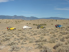
 For this trip, we (L3-Geo and Geo-Jeeper) were headed to Tonopah, to attend a geocaching weekend event. The route took us by areas that have been abandoned to time and/or changing importance. We drove through an Indian Reservation with boarded up buildings in various states of disrepair. We drove past abandoned mines and old buildings erected by those who dreamed of making their fortune in gold or silver. We drove through the town of Babbitt that was once a thriving military town supporting a nearby munitions depot. It is now a town of weed covered streets that lead nowhere and slabs of concrete that once held houses and a shopping mall. We drove passed monument after monument erected to memorialize those who fought in the various wars. We drove passed old munitions bunkers outside the town of Hawthorne, NV. And, when we finally arrived in Tonopah, we found a town determined to honor the war heroes, the mining industry, and the gamblers with a mixture of monuments, abandoned mining equipment displayed proudly, and the “required” Nevada casinos sprinkled throughout the town.
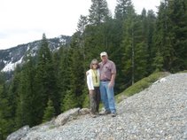
 Our primary goal as we passed all of these sights was to find the geocaches safely hidden nearby. On our trip to Tonopah we found 30 caches. Once in Tonopah we were told that new caches had been released and instead of the few we were expecting to find, we now had over 60 to seek. Our excursion to find these caches took us on some very interesting back roads. I was recovering from a recent surgery. If my doctor (and I) had known where we would really be going, he might not have released me to go on the trip as willingly as he did. But not to worry; through most of the trip, I remained in the car or stood at the bottom of the rocky mountain watching while Larry, Cynthia & Mike reached the top and found the cache. I was the official photographer but I only managed to take a very few pictures.
 The event ended after a pancake breakfast cooked by the boy scouts and we headed home. Of course, we had 6 final caches to find as we headed out of Tonopah and a few more to grab along our route. We had to bounce our way on some rough roads for a couple of them, but I held my arms across my stomach and kept a smile on my face the whole way! We even managed to avoid getting stuck in the sand but it was close. I continued to leave the rock climbing to Larry, Mike, & Cynthia. By the time we returned to Reno, we had found 100 caches for the weekend! Wow! That really was a record breaking adventure!