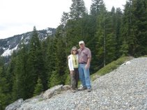
It was bound to happen! Geo-Jeeper reached a major milestone after leaving us in the dust! We brought them in to the world of Geocaching and managed to stay ahead of them most of the time. Today they found cache #7000 and we are still a couple of hundred behind them.
We had received a recommendation from 2Dee2Dee that we should go to Benicia to do some caching. We thought it was a great idea so we told Cynthia and Mike (Geo-Jeeper) about it and they said they wanted to go with us. They came down for the weekend and we headed to Benicia today. The day promised to be gorgeous weather-wise and it truly was.
We cached our way to downtown. We found some interesting caches as we tried to learn the style of the local cachers. We even ran into the owner of one of the caches. He is a young boy who caches with his friends and is pretty excited about the whole thing. He has found 47 caches and he was all set to give us all kinds of hints about caches in the area. He directed us to one that was just down the street and through the tunnel. It took him 10 times to find it so he told us it was a nano somewhere on the fence posts. We headed through the tunnel and found the cache after a brief search. We didn’t know when we might be back so we were glad for his helpful advice.
After checking out the site of the first California Capitol, the four of us had lunch at the the 1st Street Cafe. It was a small “quaint” place and we enjoyed our lunch. It seems to be a very popular place in town. While we were waiting to be seated, Mike took a stroll down the street to pick up just one more cache! And after lunch we walked down to the water front for another.
The day truly was beautiful! We spent most of the afternoon along the water front. We walked some of the pathways, took pictures, and, of course, found a few caches. We all agreed Benicia would be a great place to retire. Since Larry and I are already retired and settled, we will keep this area in mind for visits if we want to spend a day along the waterfront.
Somewhere along the way, Cynthia and Mike found #7000. I’m not sure exactly which one it was. I do know we took lots of pictures at several of the caches so we were sure to capture the moment. It was an awesome day!
Saturday, November 15, 2008
Saturday, October 25, 2008
Touring Grass Valley
October 25, 2008: It’s been a while since we have posted any of our geocaching experiences. We have certainly been looking for caches all this time, I just haven’t written about anything. Today we are off to cache in Grass Valley and Nevada City. Cynthia & Mike (Geo-Jeeper) are joining us. It should be an adventuresome day.
We never know what we might encounter in this area. PO and rattlesnakes will be at the top of our alert list. Let’s hope we don’t encounter either. So far we have been lucky. Only the berry bushes have attacked us. We have followed some of the back roads into some interesting places. The environment is woodsy and you think you are far away from everywhere--not so. There are an incredible number of houses in this area. Still, we found beautiful countryside and plenty of places to find hidden caches.
The caches we have found are interesting. Some were challenging. One was a rifle shell. It was in a hole drilled in the bottom of a 1+ inch branch. The branch was placed in a hole drilled into a pine tree. We finally spotted the branch and pulled it out. The bottom of the branch was covered with pitch. So much pitch, in fact, we almost missed the rifle shell stuck in the bottom. Once we cleared away the pitch, we had to use brute force to pull out the shell. Eventually we were able to sign the log. This was a challenging hide. Fortunately, we were up for the challenge.
We were driving on roads such as Clover Valley, Dog Bar Road, Rattlesnake road, town talk road (the early leaders of Grass Valley and Nevada City would meet here to discuss town business), burma road (no burma shave ads), whispering pines, and many many more. They all led us to Round Table Pizza for a geocaching event. Like all the other events, we were able to visit with fellow geocachers and learn more secrets to finding caches.
The day is ending and we are heading home. The wine and dinner awaits us. We will be back tomorrow to see what other roads we can find. We will have to wait to see where they will lead us.
October 26, 2008: We came back! We covered more back roads. We discovered some of the most interesting areas on these back roads. We chatted with alpacas, drove by llamas, donkeys, and horses, and passed field after field filled with horses. We also wandered through old structures. At one point we were looking for a cache along an old wall made of rocks. On the other side of the road was another wall made of rocks. Do you think the road now goes through what used to be an old building? We tried to figure what type of building it could have been. Or, was it two separate buildings? We actually prefer the idea of one building--makes it more interesting that a road runs through it.
We covered the area south west of Grass Valley all the way out to Penn Valley and back. At one point we heard gun shots as we located a cache on a back road. We hollered and they hollered back and the shooting stopped. (It’s deer season you know). We quickly signed the log and headed back to the major roads. We avoided the real back back roads after that.
The day turned out to be worth the trip in more ways than one. At one of the caches, we met another geocacher (Alpha-super Dog). We asked him about a couple of caches that we were unable to find. He provided a few hints. Back we went and we were able to find the caches. We even rechecked some we didn’t have hints for and managed to find those as well! All in all, pretty fun day! Unfortunately the camera was back home!
We never know what we might encounter in this area. PO and rattlesnakes will be at the top of our alert list. Let’s hope we don’t encounter either. So far we have been lucky. Only the berry bushes have attacked us. We have followed some of the back roads into some interesting places. The environment is woodsy and you think you are far away from everywhere--not so. There are an incredible number of houses in this area. Still, we found beautiful countryside and plenty of places to find hidden caches.
The caches we have found are interesting. Some were challenging. One was a rifle shell. It was in a hole drilled in the bottom of a 1+ inch branch. The branch was placed in a hole drilled into a pine tree. We finally spotted the branch and pulled it out. The bottom of the branch was covered with pitch. So much pitch, in fact, we almost missed the rifle shell stuck in the bottom. Once we cleared away the pitch, we had to use brute force to pull out the shell. Eventually we were able to sign the log. This was a challenging hide. Fortunately, we were up for the challenge.
We were driving on roads such as Clover Valley, Dog Bar Road, Rattlesnake road, town talk road (the early leaders of Grass Valley and Nevada City would meet here to discuss town business), burma road (no burma shave ads), whispering pines, and many many more. They all led us to Round Table Pizza for a geocaching event. Like all the other events, we were able to visit with fellow geocachers and learn more secrets to finding caches.
The day is ending and we are heading home. The wine and dinner awaits us. We will be back tomorrow to see what other roads we can find. We will have to wait to see where they will lead us.
October 26, 2008: We came back! We covered more back roads. We discovered some of the most interesting areas on these back roads. We chatted with alpacas, drove by llamas, donkeys, and horses, and passed field after field filled with horses. We also wandered through old structures. At one point we were looking for a cache along an old wall made of rocks. On the other side of the road was another wall made of rocks. Do you think the road now goes through what used to be an old building? We tried to figure what type of building it could have been. Or, was it two separate buildings? We actually prefer the idea of one building--makes it more interesting that a road runs through it.
We covered the area south west of Grass Valley all the way out to Penn Valley and back. At one point we heard gun shots as we located a cache on a back road. We hollered and they hollered back and the shooting stopped. (It’s deer season you know). We quickly signed the log and headed back to the major roads. We avoided the real back back roads after that.
The day turned out to be worth the trip in more ways than one. At one of the caches, we met another geocacher (Alpha-super Dog). We asked him about a couple of caches that we were unable to find. He provided a few hints. Back we went and we were able to find the caches. We even rechecked some we didn’t have hints for and managed to find those as well! All in all, pretty fun day! Unfortunately the camera was back home!
Wednesday, September 3, 2008
It was bound to happen!
It has been a while since we have been able to do much in the way of geocaching. Larry's hip has been out of commission for a bit and our activities have been restricted. At the same time, Mike (Geo-Jeeper) has been having problems with his back. Fortunately, Cynthia (Geojeepette) was willing to make the drive from Reno to Roseville so she and I have been able to geocache a couple of times. We managed to find quite a few caches without the help of the guys, but we certainly would be happier if they would recover soon and completely.
Today, Linda joined up with Ann Wahlenmeier (imawahl) and Don Stoye (dStoye) to walk a local bike path. A couple of the caches required a little tree climbing. Normally, Don would be happy to do the tree climbing. Today, I decided to make the leap. I had decided it was time to learn another skill in case Larry & Mike weren't able to fully resume their geocaching responsibilities.
I did it! I climbed a couple of trees, but this was probably the most challenging. And, of course, going up was easy. The getting down was a little more of a challenge but I stuck it out. Watch out Larry and Mike! We may have to draw straws next time! If this goes on much longer, I may even get Cynthia to climb some trees.
Today, Linda joined up with Ann Wahlenmeier (imawahl) and Don Stoye (dStoye) to walk a local bike path. A couple of the caches required a little tree climbing. Normally, Don would be happy to do the tree climbing. Today, I decided to make the leap. I had decided it was time to learn another skill in case Larry & Mike weren't able to fully resume their geocaching responsibilities.
I did it! I climbed a couple of trees, but this was probably the most challenging. And, of course, going up was easy. The getting down was a little more of a challenge but I stuck it out. Watch out Larry and Mike! We may have to draw straws next time! If this goes on much longer, I may even get Cynthia to climb some trees.
Tuesday, June 10, 2008
Sharks, whales, deep sea fish first. Steamboats, Indians, back roads second. #6000 Third!
We were in Nevada this weekend. We arrived late afternoon Thursday and headed home today. Our goal for the weekend was to find 6000 caches. Actually, our goal was not just to find them, but to find #6000 at the same time Geo-Jeeper found #6000. We brought them into the geocaching world and it seemed fitting that our numbers meet at some point for an important find.
Before we could get to 6000 we had to catch up to Geo-Jeeper. I think we were 30+ behind them at this point so we cached our way to Reno and then spent Friday out and about with Cynthia & Mike. Part of that time we were picking up caches that they had already found and many more that neither one of us found before.
We got a big kick out of finding so many ocean named caches--in Nevada no less! One of the more challenging was the “Whales Spout” (GC1BNQ5). Cynthia and Mike had already found this cache and you can read their adventure on their website GeoJeeper”s Great Adventure. Now it was our turn. We found the location quickly. The tricky part was in the retrieving. We went there with the plan of Larry and Mike hoisting me up on the top of the rock. If I wanted to get back down I had to trust that they would catch me! When we got there we climbed to a nearby rock so we could see the cache container (ammo can) in a spot that clearly looked like a whale’s spout. We thought about it a bit and finally Larry decided to try his trusty dusty retrieval tool that served as a light bulb changer in its former life. With a few minor adjustments, it has served us well in retrieving caches that were well beyond our reach. This cache was no exception. Larry and Mike worked in tandem and hooked the retrieval tool to the handle of the ammo can with what appeared to be minimal effort. Larry lifted the pole and out came the ammo can. That was a much better method than trying to lift me up onto the rock! We had even more fun trying to recreate the retrieval for the camera. It wasn’t as easy to hook the handle with the subsequent tries but we finally succeeded and had our pictures and movies. With this cache, we have now found a full whale! “Looking Into the Whale’s Mouth” (GCKE5K), Whale Tale (GCH8AP), and now the Whales Spout (GC1BNQ5).
Another highlight was our lunch in Virginia City at the Palace Hotel. The lunch was fine but the real treat was the discovery of Moose Drool Beer! Mike combined that with his Buffalo burger and said the combination was out of this world. OK, maybe those weren’t his exact words, but since we went on a search at the local grocery store when we got back to Reno, I assumed that’s what he meant.
Our second day we added John of “Jahoadi and John” to our mix. We caravanned through Jack’s Valley and other areas surrounding Carson City. Here we ran into Indians, bears, rocks, and who knows what else (all caches). We also made our first geocaching video. We had tried bits and pieces the day before while we figured out how to operate the camcorder and how to set it up on the dash to take the movies. We had snippets that were OK, but today was the real action! The movies turned out pretty good--both with the camcorder and our canon digital camera.
The highlights of the day were the beautiful views from several of the locations. We did have one incident where Mike spun and buried his wheels in the gravelly sand. That meant we stopped there and walked to the cache. Now that the important part was out of the picture, we could concentrate on Geo-Jeep’s predicament.
It really wasn’t a difficult situation but for entertainment we had him try to go forward again so we could see how far the tires could throw the dirt! Eventually he backed down the hill to a more stable spot and turned around. Mike almost got stuck here as well, but John gave Geo-Jeep that extra little push she needed with his hands to save the day. Of course, the cameras were not aimed in the right direction and Mike and John refused to recreate the event for me.
John was driving a Toyota FJ while the rest of us were in our jeeps. We gave him a bad time about his jeep wannabe so he was proving himself at every opportunity. He was the one parked precariously on the hillside and the one doing wheelies at sandy intersections. He was certainly putting it through it’s paces.
We started our third and final day with 5992 caches each and a destination in mind on the West side of Lake Tahoe. John joined us again as we headed over Mt. Rose to Incline Village at the north end of the lake and followed State Hwy 28 down the west side. We found several mile marker caches and several stream caches all hidden by Applejohn.
We took the Barker Pass turnoff to head for Applejohn’s Sunken Meadow cache. That was the cache we planned to make our 6000 find. We set up our camcorder and headed out. We were actually providing narration about the cache as we went. Unfortunately, mother nature had other plans. The only two roads into the trail head were blocked by snow and they were closed. Guess we would have to pick another special cache. At least John got the opportunity to race through a mud puddle. Mike and Larry had to go a little slower as their additional passengers were giving them special looks and offering sage advise about the disadvantages of roaring through the mud puddle.
Our 6000th find turned out to be “Tahoe Streams 6--Blackwood Creek” (GCICW77). The cache was in a beautiful location. We followed a dirt path along Blackwood Creek to the final spot. As we approached we handed John our digital camera and asked him to take a movie as we found the cache. At the point we had to leave the trail Cynthia and I both pointed to the left and immediately spotted the likely hiding place. We raced to the final destination and jointly removed the cache. It was a “decon” container buried under debris at the base of a fallen tree stump. The day was beautiful, the location was perfect, and the find was all that more important because it was #6000 for both L3-Geo and Geo-Jeeper. Click on the picture to see a short movie of our adventure.
We continued around Lake Tahoe and found additional caches as we went. The traffic was getting heavier and people were everywhere. When we reached the Kingsbury Grade, we headed over the top and on into Mottsville and Minden. We ended the day at Dairy Queen with a treat of blizzards and root beer floats. By the time we returned to Reno we had reached a total of 6031 caches and Geo-Jeeper had 6021. We ended with more only because we were passing right by some caches they had already found and they were happy to stop and let us find these caches. As they said: “you are here so let’s do it”. Thanks Cynthia, Mike, and John for a wonderful weekend adventure!
Before we could get to 6000 we had to catch up to Geo-Jeeper. I think we were 30+ behind them at this point so we cached our way to Reno and then spent Friday out and about with Cynthia & Mike. Part of that time we were picking up caches that they had already found and many more that neither one of us found before.
We got a big kick out of finding so many ocean named caches--in Nevada no less! One of the more challenging was the “Whales Spout” (GC1BNQ5). Cynthia and Mike had already found this cache and you can read their adventure on their website GeoJeeper”s Great Adventure. Now it was our turn. We found the location quickly. The tricky part was in the retrieving. We went there with the plan of Larry and Mike hoisting me up on the top of the rock. If I wanted to get back down I had to trust that they would catch me! When we got there we climbed to a nearby rock so we could see the cache container (ammo can) in a spot that clearly looked like a whale’s spout. We thought about it a bit and finally Larry decided to try his trusty dusty retrieval tool that served as a light bulb changer in its former life. With a few minor adjustments, it has served us well in retrieving caches that were well beyond our reach. This cache was no exception. Larry and Mike worked in tandem and hooked the retrieval tool to the handle of the ammo can with what appeared to be minimal effort. Larry lifted the pole and out came the ammo can. That was a much better method than trying to lift me up onto the rock! We had even more fun trying to recreate the retrieval for the camera. It wasn’t as easy to hook the handle with the subsequent tries but we finally succeeded and had our pictures and movies. With this cache, we have now found a full whale! “Looking Into the Whale’s Mouth” (GCKE5K), Whale Tale (GCH8AP), and now the Whales Spout (GC1BNQ5).
Another highlight was our lunch in Virginia City at the Palace Hotel. The lunch was fine but the real treat was the discovery of Moose Drool Beer! Mike combined that with his Buffalo burger and said the combination was out of this world. OK, maybe those weren’t his exact words, but since we went on a search at the local grocery store when we got back to Reno, I assumed that’s what he meant.
Our second day we added John of “Jahoadi and John” to our mix. We caravanned through Jack’s Valley and other areas surrounding Carson City. Here we ran into Indians, bears, rocks, and who knows what else (all caches). We also made our first geocaching video. We had tried bits and pieces the day before while we figured out how to operate the camcorder and how to set it up on the dash to take the movies. We had snippets that were OK, but today was the real action! The movies turned out pretty good--both with the camcorder and our canon digital camera.
The highlights of the day were the beautiful views from several of the locations. We did have one incident where Mike spun and buried his wheels in the gravelly sand. That meant we stopped there and walked to the cache. Now that the important part was out of the picture, we could concentrate on Geo-Jeep’s predicament.
John was driving a Toyota FJ while the rest of us were in our jeeps. We gave him a bad time about his jeep wannabe so he was proving himself at every opportunity. He was the one parked precariously on the hillside and the one doing wheelies at sandy intersections. He was certainly putting it through it’s paces.
We started our third and final day with 5992 caches each and a destination in mind on the West side of Lake Tahoe. John joined us again as we headed over Mt. Rose to Incline Village at the north end of the lake and followed State Hwy 28 down the west side. We found several mile marker caches and several stream caches all hidden by Applejohn.
We took the Barker Pass turnoff to head for Applejohn’s Sunken Meadow cache. That was the cache we planned to make our 6000 find. We set up our camcorder and headed out. We were actually providing narration about the cache as we went. Unfortunately, mother nature had other plans. The only two roads into the trail head were blocked by snow and they were closed. Guess we would have to pick another special cache. At least John got the opportunity to race through a mud puddle. Mike and Larry had to go a little slower as their additional passengers were giving them special looks and offering sage advise about the disadvantages of roaring through the mud puddle.
We continued around Lake Tahoe and found additional caches as we went. The traffic was getting heavier and people were everywhere. When we reached the Kingsbury Grade, we headed over the top and on into Mottsville and Minden. We ended the day at Dairy Queen with a treat of blizzards and root beer floats. By the time we returned to Reno we had reached a total of 6031 caches and Geo-Jeeper had 6021. We ended with more only because we were passing right by some caches they had already found and they were happy to stop and let us find these caches. As they said: “you are here so let’s do it”. Thanks Cynthia, Mike, and John for a wonderful weekend adventure!
Thursday, May 8, 2008
The Call of the Pacific Northwest
We are headed to Oregon/Washington to attend the graduation of one of our daughters. She is getting an AA degree and plans to continue with her schooling to get a BA and eventually a Masters in Education. We will be rooting for her the entire way.
Naturally, we just don’t drive somewhere any more. We always have to stop and pick up a couple of caches. Today we will be checking out the Hwy 20 area west of Wiliams. We have an ulterior motive. There is one particular cache we need to complete a puzzle on another cache and it is located on Bear Valley Road of Hwy 20. We could just drive straight to that cache, find it, and then on to our final destination. Nah! It would hurt to much to pass up all those other caches!
We got a late start as we had some things to attend to this morning. It was a little after 10 when we could finally say “On the Road Again”. Our first stop will be in the town of Williams.
We left Williams and headed west on Hwy 20. We picked up a few caches along the road before turning off on Bear Valley Road. (Have you ever noticed how many Bear Valleys there are in California?). Bear Valley Road is a rocky dirt road that is well maintained. We were a little concerned we might need our jeep but we did just fine with the Sequoia.
We took a little side jaunt on Wilbur Springs Road to grab three caches. We were surprised to-find the Wilbur Hot Springs Resort at the end of the road. We couldn’t see the resort from where we were but it is an isolated area and looks like it would definitely be exclusive!
We made our last leg up Bear Valley Road to meet with Dan Quail. He was hiding out in an interesting old stump. As we arrived at the “spot”, we knew instantly where to look. We had to be at the right angle, but there it was. We signed the log, took a few pictures, and reluctantly headed back down the road. This was a nice little area. We saw lots of birds. Too bad we didn’t have a little more time to enjoy it.
Naturally, we just don’t drive somewhere any more. We always have to stop and pick up a couple of caches. Today we will be checking out the Hwy 20 area west of Wiliams. We have an ulterior motive. There is one particular cache we need to complete a puzzle on another cache and it is located on Bear Valley Road of Hwy 20. We could just drive straight to that cache, find it, and then on to our final destination. Nah! It would hurt to much to pass up all those other caches!
We got a late start as we had some things to attend to this morning. It was a little after 10 when we could finally say “On the Road Again”. Our first stop will be in the town of Williams.
We left Williams and headed west on Hwy 20. We picked up a few caches along the road before turning off on Bear Valley Road. (Have you ever noticed how many Bear Valleys there are in California?). Bear Valley Road is a rocky dirt road that is well maintained. We were a little concerned we might need our jeep but we did just fine with the Sequoia.
We took a little side jaunt on Wilbur Springs Road to grab three caches. We were surprised to-find the Wilbur Hot Springs Resort at the end of the road. We couldn’t see the resort from where we were but it is an isolated area and looks like it would definitely be exclusive!
We made our last leg up Bear Valley Road to meet with Dan Quail. He was hiding out in an interesting old stump. As we arrived at the “spot”, we knew instantly where to look. We had to be at the right angle, but there it was. We signed the log, took a few pictures, and reluctantly headed back down the road. This was a nice little area. We saw lots of birds. Too bad we didn’t have a little more time to enjoy it.
Sunday, April 20, 2008
Folsom Day 2
We actually slept in this morning. Well, sort of. We didn’t need to leave until 8:00 so we figured we could sleep in a little and enjoy the morning. Unfortunately, my body didn’t cooperate and I was up at 5:00. I managed to get lots of things done while I waited for the others.
At 8:00 AM promptly, we headed to Folsom for the second day in a row. We were bound and determined we were going to clear out a bunch of caches in another area of Folsom. I think we did a pretty good job. But first, we had to start our day at Starbucks. Somehow, it just seems better to start the day this way.
Throughout the day we found several wetlands areas, shaded bike trails, various parks, wooden bridges, and several caches. Throughout the day, the weather couldn’t make up its mind. We had moments of downright cold (the wind was a little tough), and moments when it was on the warm side. We couldn’t decide whether we needed our jackets or not so we changed from moment to moment! It was an interesting day.
We returned home sometime around 6:00 and managed a quick fajita dinner. We are all tired but it was worth it. We came pretty close to getting in our 10,000 steps for the day and we found over 20 caches. One of these days we will have to travel some of the trails we discovered today as they are intended--by bike.
At 8:00 AM promptly, we headed to Folsom for the second day in a row. We were bound and determined we were going to clear out a bunch of caches in another area of Folsom. I think we did a pretty good job. But first, we had to start our day at Starbucks. Somehow, it just seems better to start the day this way.
Throughout the day we found several wetlands areas, shaded bike trails, various parks, wooden bridges, and several caches. Throughout the day, the weather couldn’t make up its mind. We had moments of downright cold (the wind was a little tough), and moments when it was on the warm side. We couldn’t decide whether we needed our jackets or not so we changed from moment to moment! It was an interesting day.
We returned home sometime around 6:00 and managed a quick fajita dinner. We are all tired but it was worth it. We came pretty close to getting in our 10,000 steps for the day and we found over 20 caches. One of these days we will have to travel some of the trails we discovered today as they are intended--by bike.
Sunday, April 6, 2008
Looking into the Whale's Mouth
It was raining! Ok, it was a heavy mist. I think it is semantics! The weather report says we would have occasional showers. Right now it is more than occasional. Fortunately, Raley’s was open and had ponchos, hats and gloves! We stocked up for the hike to the cache. We were not going to let anything get in our way of finding this particular cache.
We did see occasional blue patches in the sky as we headed north from Ukiah. Hopefully some of those blue skies will be over the coast near the cache. Doesn’t matter, though. We will make this “walk” to the cache. We will be celebrating three things when we reach the cache: 1) Cynthia’s birthday (officially tomorrow); Geo-Jeeper’s 5600 find; and just the fact that we did it. We have been hearing about this cache (Looking into the Whale’s Mouth--GCKE5K) since the beginning and it is one of those “must do” caches to gain the respect of others who have completed the Northern California Delorme Challenge. We won’t let a little rain stop us. Hopefully, it will stop the Elk from creating a problem on the trail--one of those things frequently mentioned in the posts on the cache page.
We arrived at Needle Rock Museum and prepared for our hike. You should have seen us! If you look at the pictures, you can see how ridiculous we looked. We were all decked out in our rain ponchos when we started the trip. By the time we returned, we had shed all the rain gear and a few other layers of clothing.
It was a gorgeous hike. We thought it would be a quick in and out, but it wasn’t. The wild flowers were in full bloom and the elk were in abundance. We spent a lot of time pausing to take pictures. We were practically eyeball to eyeball with the elk and they were not the least bit afraid of us. I could say we weren’t afraid of them either, but we did worry about maintaining our distance. We did not want to deal with an elk charge.
Some of the time it was like we were in a rain forest. No, it didn’t really rain that much--just a lot of sprinkles. It’s just that the vegetation was lush and wet from the rain and the flowers were gorgeous. At times we were under trees crossing creeks and then we were in the full sun skirting past the elk. We probably took a lot more time than we needed.
When we arrived at the end of the trail, we still had to head downhill along an animal track for about 300 feet. Unfortunately, the animal track was not clearly marked. I guess the animals have chosen other routes through this area and the plants have grown over the trail. So we headed down the hill very carefully. If we slipped, we would actually be on the beach at the mouth of whale cove, but it was a long way down. We reached the exact spot of the cache and pulled out the rusted ammo can and signed the log. Of course, we had to take bunches of pictures. This was Geo-Jeeper’s (Cynthia & Mike’s) 5600th find and tomorrow is Cynthia’s 60th birthday. Plus, this took care of quad 62 of the Northern California Delorme Challenge. It was a great day for celebrations.
The hike back to our car took a little less time than the hike to the cache. We were concerned at one point that we might be a little delayed. As we approached one meadow, we discovered that a herd of elk had set up residency on and around the trail. They didn’t seem to care that we were there and they were in no hurry to move. So, we advanced slowly along the trail. A couple of them moved aside. A few others tried the old stare down. We kept a steady stream of conversation going and did a little picture taking while we moved through them. We wanted them to understand that we had no intention of hurting them as long as they didn’t hurt us. It wasn’t until we got back to the car that we saw the sign that said: “Wild elk! Danger! Do not approach on foot!” Un oh! I guess we were just plain lucky or they have gotten so used to people that they never considered us a threat. It really doesn’t matter. We arrived back at the car without a single elk mark on us.
Our main adventure for the day was over. We piled back in the car to make the long trek back to Roseville. We won’t get there until passed “wine time” and the boys in the front seat will be whining about that for a long time. Of course, the most important thing will be whether we will be able to move by the time we get to Roseville. The muscles are achy and starting to stiffen a little, but we had a great time the whole trip.
We did see occasional blue patches in the sky as we headed north from Ukiah. Hopefully some of those blue skies will be over the coast near the cache. Doesn’t matter, though. We will make this “walk” to the cache. We will be celebrating three things when we reach the cache: 1) Cynthia’s birthday (officially tomorrow); Geo-Jeeper’s 5600 find; and just the fact that we did it. We have been hearing about this cache (Looking into the Whale’s Mouth--GCKE5K) since the beginning and it is one of those “must do” caches to gain the respect of others who have completed the Northern California Delorme Challenge. We won’t let a little rain stop us. Hopefully, it will stop the Elk from creating a problem on the trail--one of those things frequently mentioned in the posts on the cache page.
We arrived at Needle Rock Museum and prepared for our hike. You should have seen us! If you look at the pictures, you can see how ridiculous we looked. We were all decked out in our rain ponchos when we started the trip. By the time we returned, we had shed all the rain gear and a few other layers of clothing.
It was a gorgeous hike. We thought it would be a quick in and out, but it wasn’t. The wild flowers were in full bloom and the elk were in abundance. We spent a lot of time pausing to take pictures. We were practically eyeball to eyeball with the elk and they were not the least bit afraid of us. I could say we weren’t afraid of them either, but we did worry about maintaining our distance. We did not want to deal with an elk charge.
Some of the time it was like we were in a rain forest. No, it didn’t really rain that much--just a lot of sprinkles. It’s just that the vegetation was lush and wet from the rain and the flowers were gorgeous. At times we were under trees crossing creeks and then we were in the full sun skirting past the elk. We probably took a lot more time than we needed.
When we arrived at the end of the trail, we still had to head downhill along an animal track for about 300 feet. Unfortunately, the animal track was not clearly marked. I guess the animals have chosen other routes through this area and the plants have grown over the trail. So we headed down the hill very carefully. If we slipped, we would actually be on the beach at the mouth of whale cove, but it was a long way down. We reached the exact spot of the cache and pulled out the rusted ammo can and signed the log. Of course, we had to take bunches of pictures. This was Geo-Jeeper’s (Cynthia & Mike’s) 5600th find and tomorrow is Cynthia’s 60th birthday. Plus, this took care of quad 62 of the Northern California Delorme Challenge. It was a great day for celebrations.
The hike back to our car took a little less time than the hike to the cache. We were concerned at one point that we might be a little delayed. As we approached one meadow, we discovered that a herd of elk had set up residency on and around the trail. They didn’t seem to care that we were there and they were in no hurry to move. So, we advanced slowly along the trail. A couple of them moved aside. A few others tried the old stare down. We kept a steady stream of conversation going and did a little picture taking while we moved through them. We wanted them to understand that we had no intention of hurting them as long as they didn’t hurt us. It wasn’t until we got back to the car that we saw the sign that said: “Wild elk! Danger! Do not approach on foot!” Un oh! I guess we were just plain lucky or they have gotten so used to people that they never considered us a threat. It really doesn’t matter. We arrived back at the car without a single elk mark on us.
Our main adventure for the day was over. We piled back in the car to make the long trek back to Roseville. We won’t get there until passed “wine time” and the boys in the front seat will be whining about that for a long time. Of course, the most important thing will be whether we will be able to move by the time we get to Roseville. The muscles are achy and starting to stiffen a little, but we had a great time the whole trip.
Saturday, April 5, 2008
The 2008 Sonoma County GeoRally and Winter GeOlymp
Time to get on the road and head to the Sonoma 2008 Georally. Since we were in Ukiah, we had about an hour and a half to the start of the rally. We did manage to grab one cache in Ukiah that was just down the road from our hotel. We figured we needed to start the day off right to give us incentive.
It has been a while since we have been in this part of the state. We were surprised to see so many vineyards this far north. They have probably been here a long time but we haven’t so everything was a pleasant surprise on this trip! It was a pretty drive. Too bad we were on a mission so we couldn’t stop to enjoy all aspects of it. We couldn’t even stop for caches as we wanted to be at the rally in time to get all the instructions.
We arrived at the Cotati Park and Ride along Highway 101 a little before start time. We had an opportunity to enjoy a cup of coffee from the local java place before we received the instructions for the 2008 Sonoma Rally. There were three routes and we ended up on the Northern route that took us north of Cotati to places like Rohnert Park, Healdsburg, Sebastopol, and on a lot of back roads through the vineyards.
We had lots of questions to answer as we followed the predetermined route. We did take a little time in the beginning to find some caches along the way, but soon we were in an area that was outside our anticipated caching area and we didn’t have any caches to find. So, we concentrated on the route and the questions.
Along the way, we passed two dairies of the year, a purple hubcap lady, a black and white metal cow structure, an orange truck with a dog sculpture in the front seat, several churches, a few bagel shops, a couple of old bridges, historic district 2, a druid, poor man’s flat, at least six palm trees, and, a few roads twice. We also saw emil, pinestone, R-L Ranch, a mailbox covered with ladybugs, a tree farm, a man carrying a canoe, Black Emerald Winery, the home of the hounds, hoof beat park. West North Street, and a couple of school roads.
When we were all finished and joined the others for a pasta dinner, we learned that we make a pretty good rally team. We came in tied for second for those following the north route. We could have filed a protest because there were really 5 churches on one road and everyone agreed but the “judge”. He said there were only 4. We all wanted to take him for a ride, but since it had been a fun day, we let him off the hook. Besides, we were happy with second place!
After dinner we headed back to Ukiah for the night. We had one more mission on this trip and that was to look into the mouth of the whale--tomorrow. We needed our sleep tonight!
It has been a while since we have been in this part of the state. We were surprised to see so many vineyards this far north. They have probably been here a long time but we haven’t so everything was a pleasant surprise on this trip! It was a pretty drive. Too bad we were on a mission so we couldn’t stop to enjoy all aspects of it. We couldn’t even stop for caches as we wanted to be at the rally in time to get all the instructions.
We arrived at the Cotati Park and Ride along Highway 101 a little before start time. We had an opportunity to enjoy a cup of coffee from the local java place before we received the instructions for the 2008 Sonoma Rally. There were three routes and we ended up on the Northern route that took us north of Cotati to places like Rohnert Park, Healdsburg, Sebastopol, and on a lot of back roads through the vineyards.
We had lots of questions to answer as we followed the predetermined route. We did take a little time in the beginning to find some caches along the way, but soon we were in an area that was outside our anticipated caching area and we didn’t have any caches to find. So, we concentrated on the route and the questions.
Along the way, we passed two dairies of the year, a purple hubcap lady, a black and white metal cow structure, an orange truck with a dog sculpture in the front seat, several churches, a few bagel shops, a couple of old bridges, historic district 2, a druid, poor man’s flat, at least six palm trees, and, a few roads twice. We also saw emil, pinestone, R-L Ranch, a mailbox covered with ladybugs, a tree farm, a man carrying a canoe, Black Emerald Winery, the home of the hounds, hoof beat park. West North Street, and a couple of school roads.
When we were all finished and joined the others for a pasta dinner, we learned that we make a pretty good rally team. We came in tied for second for those following the north route. We could have filed a protest because there were really 5 churches on one road and everyone agreed but the “judge”. He said there were only 4. We all wanted to take him for a ride, but since it had been a fun day, we let him off the hook. Besides, we were happy with second place!
After dinner we headed back to Ukiah for the night. We had one more mission on this trip and that was to look into the mouth of the whale--tomorrow. We needed our sleep tonight!
Friday, April 4, 2008
The California Coastal Run
It’s great to be out geocaching! What more can I say? It has been too long and we really needed to get out and about! We were on another great adventure with Geo-Jeeper (Cynthia & Mike)
Friday, April 4, we drove up the coast along Highway 1. We are bound and determined to complete the Northern California Delorme Challenge this year. It was a beautiful day to drive along the coast and pick up several quads along the way. It was also a beautiful day to take pictures.
We headed south to go north. We worked our way over to 101 south and then picked up CA Highway 1 North near Sausalito. We were trying to figure out the last time we actually drove up Highway 1 from this location. Basically, we haven’t--or so we thought. As we drove along we racked our brains and eventually decided we had been here before. We decided that a long time ago we had been to Muir Woods and to Bodega Bay. Regardless, we were properly impressed with the wooded surroundings--the eucalyptus trees were beautiful. At one point we passed fields of purple bushes. We finally decided they were heather. Of course our cameras were in the back of the car! Isn’t that the way it always is?
We started with Quad 103 (Stinson Beach) and headed up the coast through 93 (we already had this one but we covered it again), 92, 82, 72 and finally 73. We just picked caches along the highway. They were not difficult caches, but they led us to some very interesting locations. The views of the ocean and the coastline were incredibly good.
We stopped for lunch at the Rivers End Fine Dining in Jenner. The selections were a little out of our taste range, but they did have a burger and fish and chips so we were happy. We did have a lovely view of the ocean and one bird that was entertaining us by “riding the airflow”. He spent a lot of time hovering outside our window.
After lunch we made a “Stop for the Sea Lions”. We found the cache quickly, but then we spent some time enjoying the Sea Lions sunbathing on the beach below. They looked like rocks on the sand. Every once in a while one would move. We took lots of pictures, but the sea lions were all too tired to entertain us. One of them finally went into the water, but mostly they slept.
A little further up the road we were headed for “Amazing View but Watch for the Cows”. As we approached the coordinates for the cache, we ran into cows all over the roadway. Ok, we didn’t actually run into them, we approached with caution. They didn’t seem to be bothered and kept munching away on the grass. One cow stayed in his lane and kept meandering up the road. We eventually made our way through them. Cows in the road--seems to be a routine when we are on a quad run. On one of our last big quad runs, we were right in the middle of a bunch of cows being herded down the road. We have also encountered cows on other trips. I guess we should just expect to see them in the road from now on.
The further north we traveled, the grayer the skies, but the more yellow the poppies. It was probably the contrast, but they were pretty.
We finally reached the little town of Gualala. This is where we were supposed to eat lunch, but I had my info wrong. Too bad, we would have a few more choices here than we did back in Jenner. We were concerned about this cache (JJRQ) but we had no trouble finding it. I guess some previous finders felt intimidated by the people inside the building and didn’t look hard enough. We figured the people inside must know about it, so we walked right up and retrieved the cache. We will have to wait until next time to try out the lunch places.
Finally! A light house! If you go to the coast, you have to go to a light house. Right? We thought we had found one before but it turned out to be a solar light (with a cache inside) along the side of the road. “Lighthouse Stay” was actually on the road to a lighthouse. We went all the way to the end and took the required photos of the lighthouse. As lighthouses go, it wasn’t so spectacular, but at least we saw it! We didn’t go into the museum as we have one more quad and we are running out of time. We still have to make it to Ukiah tonight.
Our final quad took us to the town of Mendocino. One of the caches was out along the cliffs and required a pleasant walk to get there. I’m glad we chose to make the walk. We did enjoy some beautiful sights. We also found an excellent coffee shop here. Sorry---it wasn’t Starbucks or Peet’s or any of the other well known coffee houses. It was Moody’s Organic Coffee House. The coffee was excellent! We recommend it to others and will stop by again the next time we are in the area.
The day actually ended in Ukiah at the Holiday Inn Express. I think this is the first time we have stayed at an HIE that wasn’t full. It was kind of eerie. There weren’t many cars in the parking lot. If we wanted to be ridiculous, we could blame it on the fire truck parked outside sounding his siren now and again. Our guess is that a firefighter from somewhere else, or a relative of one of the local firefighters was staying here with us. He had two children. The fire truck showed up to entertain the kids. They got a tour of and a ride in the fire truck and, of course, got to listen to the siren several times. No one offered us a ride in the fire truck! Maybe next time.
Friday, April 4, we drove up the coast along Highway 1. We are bound and determined to complete the Northern California Delorme Challenge this year. It was a beautiful day to drive along the coast and pick up several quads along the way. It was also a beautiful day to take pictures.
We headed south to go north. We worked our way over to 101 south and then picked up CA Highway 1 North near Sausalito. We were trying to figure out the last time we actually drove up Highway 1 from this location. Basically, we haven’t--or so we thought. As we drove along we racked our brains and eventually decided we had been here before. We decided that a long time ago we had been to Muir Woods and to Bodega Bay. Regardless, we were properly impressed with the wooded surroundings--the eucalyptus trees were beautiful. At one point we passed fields of purple bushes. We finally decided they were heather. Of course our cameras were in the back of the car! Isn’t that the way it always is?
We started with Quad 103 (Stinson Beach) and headed up the coast through 93 (we already had this one but we covered it again), 92, 82, 72 and finally 73. We just picked caches along the highway. They were not difficult caches, but they led us to some very interesting locations. The views of the ocean and the coastline were incredibly good.
We stopped for lunch at the Rivers End Fine Dining in Jenner. The selections were a little out of our taste range, but they did have a burger and fish and chips so we were happy. We did have a lovely view of the ocean and one bird that was entertaining us by “riding the airflow”. He spent a lot of time hovering outside our window.
After lunch we made a “Stop for the Sea Lions”. We found the cache quickly, but then we spent some time enjoying the Sea Lions sunbathing on the beach below. They looked like rocks on the sand. Every once in a while one would move. We took lots of pictures, but the sea lions were all too tired to entertain us. One of them finally went into the water, but mostly they slept.
A little further up the road we were headed for “Amazing View but Watch for the Cows”. As we approached the coordinates for the cache, we ran into cows all over the roadway. Ok, we didn’t actually run into them, we approached with caution. They didn’t seem to be bothered and kept munching away on the grass. One cow stayed in his lane and kept meandering up the road. We eventually made our way through them. Cows in the road--seems to be a routine when we are on a quad run. On one of our last big quad runs, we were right in the middle of a bunch of cows being herded down the road. We have also encountered cows on other trips. I guess we should just expect to see them in the road from now on.
The further north we traveled, the grayer the skies, but the more yellow the poppies. It was probably the contrast, but they were pretty.
We finally reached the little town of Gualala. This is where we were supposed to eat lunch, but I had my info wrong. Too bad, we would have a few more choices here than we did back in Jenner. We were concerned about this cache (JJRQ) but we had no trouble finding it. I guess some previous finders felt intimidated by the people inside the building and didn’t look hard enough. We figured the people inside must know about it, so we walked right up and retrieved the cache. We will have to wait until next time to try out the lunch places.
Finally! A light house! If you go to the coast, you have to go to a light house. Right? We thought we had found one before but it turned out to be a solar light (with a cache inside) along the side of the road. “Lighthouse Stay” was actually on the road to a lighthouse. We went all the way to the end and took the required photos of the lighthouse. As lighthouses go, it wasn’t so spectacular, but at least we saw it! We didn’t go into the museum as we have one more quad and we are running out of time. We still have to make it to Ukiah tonight.
Our final quad took us to the town of Mendocino. One of the caches was out along the cliffs and required a pleasant walk to get there. I’m glad we chose to make the walk. We did enjoy some beautiful sights. We also found an excellent coffee shop here. Sorry---it wasn’t Starbucks or Peet’s or any of the other well known coffee houses. It was Moody’s Organic Coffee House. The coffee was excellent! We recommend it to others and will stop by again the next time we are in the area.
The day actually ended in Ukiah at the Holiday Inn Express. I think this is the first time we have stayed at an HIE that wasn’t full. It was kind of eerie. There weren’t many cars in the parking lot. If we wanted to be ridiculous, we could blame it on the fire truck parked outside sounding his siren now and again. Our guess is that a firefighter from somewhere else, or a relative of one of the local firefighters was staying here with us. He had two children. The fire truck showed up to entertain the kids. They got a tour of and a ride in the fire truck and, of course, got to listen to the siren several times. No one offered us a ride in the fire truck! Maybe next time.
Tuesday, January 8, 2008
On The Road to HOME--We Made It!!!
We woke up this morning intending to spend a little relaxing time before heading over the Sierras. The wind was howling and the weather person indicated there might be snow showers today. We checked the road conditions and everything was clear at the moment. We decided not to wait so we hurriedly packed our stuff and headed for home.
We didn’t really see it last night, but Reno is covered with snow from the “BIG” storm. They got tons of snow here over the weekend and it has been so cold that none of it has melted. The roads have been plowed so they are clear. We will keep our fingers crossed that the roads remain clear the entire way home.
It was snowing a little over the Sierras and the road was icy but no controls. We did have lots of blowing snow! We followed behind a caltrans sanding truck for a little while and a couple of big rigs. At one point all the trucks were pulling over--might have been a brake check. We kept on going but we were not moving very fast. It was still pretty icy!!!!!!!!!! I took some pictures and a couple of movies. We just kept on moving!!
There is now a highway patrol man in front leading the traffic. I guess we are wooses because lots of people are passing us but we are taking it easy and sticking with the slow pokes. We have reached the summit so we figure it can only get better! We are also hungry. We left in such a hurry we didn’t even have breakfast or make our traditional stop at Starbucks! And, of course, you know, snow is not one of my favorite things!
Some of the smaller non-4X4 cars are starting to pull over to chain up. We are not sure how much longer before they will be requiring chains for non-4X4 vehicles. We are still moving...... At least it is not blowing as much on this part of the road, but even the “zoomies” are slowing down now. It has been snowing steadily but not heavily. By the way, when I remembered to look, the temperature was 22ยบ.
We are listening to the radio but still no chain controls. We don’t really care because we have 4X4, but I sure don’t like these roads! I will be glad when we get down the mountain! Traffic is stopped on the other side but we don’t know why. Since there aren’t any chain controls (according to 1610), I’m guessing there was an accident. We did keep passing the electronic signs that talked about a chain control speed of 30 mph!
We are at Emigrant at 9:20 AM and there is still plenty of ice and snow. For a while there it was like we were all by ourselves. The wind was blowing the snow and we couldn’t see that far in front of us! This is not a particularly fast trip home! And I think it is snowing more on the downhill side and building up on the roadway--except where the trucks go. Of course, I could be exaggerating as I am not fond of this weather (I think I said that before)! Are we home yet?
Where is everyone? There is no one going East. We are beginning to wonder if they have stopped traffic down here and closed East bound because of that accicent. We are now at Alta and on on wet only pavement heading west and there is absolutely no one on the other side. It is kind of eerie! AHa! we have found the east bounders--just above Gold Run! The sign says chains required and they are stopping people and checking. The trucks are all stopped a little further down. There is no need to chain up here but they must have put them in effect higher up. I’m glad we are out of it--well, almost out of it. It is still snowing, but not heavily
We think we got out of Reno just in time! I checked road conditions and chains are definitely required east of Gold Run! Had we waited much longer to leave, this trip might be even longer or not at all! The Mac@Night folks will be grateful we are back in time to lead the meeting tonight. I know we are!
The elevation is 2400 and it is now mostly rain with a little snow! Whew! We made it! Not much longer and we will be HOME!!!!
And before you ask: No, we did not geocache on this leg of our trip! Our only goal was to get over the mountain and boy are we glad we accomplished that goal!
We didn’t really see it last night, but Reno is covered with snow from the “BIG” storm. They got tons of snow here over the weekend and it has been so cold that none of it has melted. The roads have been plowed so they are clear. We will keep our fingers crossed that the roads remain clear the entire way home.
It was snowing a little over the Sierras and the road was icy but no controls. We did have lots of blowing snow! We followed behind a caltrans sanding truck for a little while and a couple of big rigs. At one point all the trucks were pulling over--might have been a brake check. We kept on going but we were not moving very fast. It was still pretty icy!!!!!!!!!! I took some pictures and a couple of movies. We just kept on moving!!
We are listening to the radio but still no chain controls. We don’t really care because we have 4X4, but I sure don’t like these roads! I will be glad when we get down the mountain! Traffic is stopped on the other side but we don’t know why. Since there aren’t any chain controls (according to 1610), I’m guessing there was an accident. We did keep passing the electronic signs that talked about a chain control speed of 30 mph!
Where is everyone? There is no one going East. We are beginning to wonder if they have stopped traffic down here and closed East bound because of that accicent. We are now at Alta and on on wet only pavement heading west and there is absolutely no one on the other side. It is kind of eerie! AHa! we have found the east bounders--just above Gold Run! The sign says chains required and they are stopping people and checking. The trucks are all stopped a little further down. There is no need to chain up here but they must have put them in effect higher up. I’m glad we are out of it--well, almost out of it. It is still snowing, but not heavily
We think we got out of Reno just in time! I checked road conditions and chains are definitely required east of Gold Run! Had we waited much longer to leave, this trip might be even longer or not at all! The Mac@Night folks will be grateful we are back in time to lead the meeting tonight. I know we are!
The elevation is 2400 and it is now mostly rain with a little snow! Whew! We made it! Not much longer and we will be HOME!!!!
And before you ask: No, we did not geocache on this leg of our trip! Our only goal was to get over the mountain and boy are we glad we accomplished that goal!
Subscribe to:
Posts (Atom)