It was raining! Ok, it was a heavy mist. I think it is semantics! The weather report says we would have occasional showers. Right now it is more than occasional. Fortunately, Raley’s was open and had ponchos, hats and gloves! We stocked up for the hike to the cache. We were not going to let anything get in our way of finding this particular cache.
We did see occasional blue patches in the sky as we headed north from Ukiah. Hopefully some of those blue skies will be over the coast near the cache. Doesn’t matter, though. We will make this “walk” to the cache. We will be celebrating three things when we reach the cache: 1) Cynthia’s birthday (officially tomorrow); Geo-Jeeper’s 5600 find; and just the fact that we did it. We have been hearing about this cache (Looking into the Whale’s Mouth--GCKE5K) since the beginning and it is one of those “must do” caches to gain the respect of others who have completed the Northern California Delorme Challenge. We won’t let a little rain stop us. Hopefully, it will stop the Elk from creating a problem on the trail--one of those things frequently mentioned in the posts on the cache page.
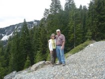
We arrived at Needle Rock Museum and prepared for our hike. You should have seen us! If you look at the pictures, you can see how ridiculous we looked. We were all decked out in our rain ponchos when we started the trip. By the time we returned, we had shed all the rain gear and a few other layers of clothing.
It was a gorgeous hike. We thought it would be a quick in and out, but it wasn’t. The wild flowers were in full bloom and the elk were in abundance. We spent a lot of time pausing to take pictures. We were practically eyeball to eyeball with the elk and they were not the least bit afraid of us. I could say we weren’t afraid of them either, but we did worry about maintaining our distance. We did not want to deal with an elk charge.
Some of the time it was like we were in a rain forest. No, it didn’t really rain that much--just a lot of sprinkles. It’s just that the vegetation was lush and wet from the rain and the flowers were gorgeous. At times we were under trees crossing creeks and then we were in the full sun skirting past the elk. We probably took a lot more time than we needed.
When we arrived at the end of the trail, we still had to head downhill along an animal track for about 300 feet. Unfortunately, the animal track was not clearly marked. I guess the animals have chosen other routes through this area and the plants have grown over the trail. So we headed down the hill very carefully. If we slipped, we would actually be on the beach at the mouth of whale cove, but it was a long way down. We reached the exact spot of the cache and pulled out the rusted ammo can and signed the log. Of course, we had to take bunches of pictures. This was Geo-Jeeper’s (Cynthia & Mike’s) 5600th find and tomorrow is Cynthia’s 60th birthday. Plus, this took care of quad 62 of the Northern California Delorme Challenge. It was a great day for celebrations.
The hike back to our car took a little less time than the hike to the cache. We were concerned at one point that we might be a little delayed. As we approached one meadow, we discovered that a herd of elk had set up residency on and around the trail. They didn’t seem to care that we were there and they were in no hurry to move. So, we advanced slowly along the trail. A couple of them moved aside. A few others tried the old stare down. We kept a steady stream of conversation going and did a little picture taking while we moved through them. We wanted them to understand that we had no intention of hurting them as long as they didn’t hurt us. It wasn’t until we got back to the car that we saw the sign that said: “Wild elk! Danger! Do not approach on foot!” Un oh! I guess we were just plain lucky or they have gotten so used to people that they never considered us a threat. It really doesn’t matter. We arrived back at the car without a single elk mark on us.
Our main adventure for the day was over. We piled back in the car to make the long trek back to Roseville. We won’t get there until passed “wine time” and the boys in the front seat will be whining about that for a long time. Of course, the most important thing will be whether we will be able to move by the time we get to Roseville. The muscles are achy and starting to stiffen a little, but we had a great time the whole trip.
Sunday, April 6, 2008
Saturday, April 5, 2008
The 2008 Sonoma County GeoRally and Winter GeOlymp
Time to get on the road and head to the Sonoma 2008 Georally. Since we were in Ukiah, we had about an hour and a half to the start of the rally. We did manage to grab one cache in Ukiah that was just down the road from our hotel. We figured we needed to start the day off right to give us incentive.
It has been a while since we have been in this part of the state. We were surprised to see so many vineyards this far north. They have probably been here a long time but we haven’t so everything was a pleasant surprise on this trip! It was a pretty drive. Too bad we were on a mission so we couldn’t stop to enjoy all aspects of it. We couldn’t even stop for caches as we wanted to be at the rally in time to get all the instructions.
We arrived at the Cotati Park and Ride along Highway 101 a little before start time. We had an opportunity to enjoy a cup of coffee from the local java place before we received the instructions for the 2008 Sonoma Rally. There were three routes and we ended up on the Northern route that took us north of Cotati to places like Rohnert Park, Healdsburg, Sebastopol, and on a lot of back roads through the vineyards.
We had lots of questions to answer as we followed the predetermined route. We did take a little time in the beginning to find some caches along the way, but soon we were in an area that was outside our anticipated caching area and we didn’t have any caches to find. So, we concentrated on the route and the questions.
Along the way, we passed two dairies of the year, a purple hubcap lady, a black and white metal cow structure, an orange truck with a dog sculpture in the front seat, several churches, a few bagel shops, a couple of old bridges, historic district 2, a druid, poor man’s flat, at least six palm trees, and, a few roads twice. We also saw emil, pinestone, R-L Ranch, a mailbox covered with ladybugs, a tree farm, a man carrying a canoe, Black Emerald Winery, the home of the hounds, hoof beat park. West North Street, and a couple of school roads.
When we were all finished and joined the others for a pasta dinner, we learned that we make a pretty good rally team. We came in tied for second for those following the north route. We could have filed a protest because there were really 5 churches on one road and everyone agreed but the “judge”. He said there were only 4. We all wanted to take him for a ride, but since it had been a fun day, we let him off the hook. Besides, we were happy with second place!
After dinner we headed back to Ukiah for the night. We had one more mission on this trip and that was to look into the mouth of the whale--tomorrow. We needed our sleep tonight!
It has been a while since we have been in this part of the state. We were surprised to see so many vineyards this far north. They have probably been here a long time but we haven’t so everything was a pleasant surprise on this trip! It was a pretty drive. Too bad we were on a mission so we couldn’t stop to enjoy all aspects of it. We couldn’t even stop for caches as we wanted to be at the rally in time to get all the instructions.
We arrived at the Cotati Park and Ride along Highway 101 a little before start time. We had an opportunity to enjoy a cup of coffee from the local java place before we received the instructions for the 2008 Sonoma Rally. There were three routes and we ended up on the Northern route that took us north of Cotati to places like Rohnert Park, Healdsburg, Sebastopol, and on a lot of back roads through the vineyards.
We had lots of questions to answer as we followed the predetermined route. We did take a little time in the beginning to find some caches along the way, but soon we were in an area that was outside our anticipated caching area and we didn’t have any caches to find. So, we concentrated on the route and the questions.
Along the way, we passed two dairies of the year, a purple hubcap lady, a black and white metal cow structure, an orange truck with a dog sculpture in the front seat, several churches, a few bagel shops, a couple of old bridges, historic district 2, a druid, poor man’s flat, at least six palm trees, and, a few roads twice. We also saw emil, pinestone, R-L Ranch, a mailbox covered with ladybugs, a tree farm, a man carrying a canoe, Black Emerald Winery, the home of the hounds, hoof beat park. West North Street, and a couple of school roads.
When we were all finished and joined the others for a pasta dinner, we learned that we make a pretty good rally team. We came in tied for second for those following the north route. We could have filed a protest because there were really 5 churches on one road and everyone agreed but the “judge”. He said there were only 4. We all wanted to take him for a ride, but since it had been a fun day, we let him off the hook. Besides, we were happy with second place!
After dinner we headed back to Ukiah for the night. We had one more mission on this trip and that was to look into the mouth of the whale--tomorrow. We needed our sleep tonight!
Friday, April 4, 2008
The California Coastal Run
It’s great to be out geocaching! What more can I say? It has been too long and we really needed to get out and about! We were on another great adventure with Geo-Jeeper (Cynthia & Mike)
Friday, April 4, we drove up the coast along Highway 1. We are bound and determined to complete the Northern California Delorme Challenge this year. It was a beautiful day to drive along the coast and pick up several quads along the way. It was also a beautiful day to take pictures.
We headed south to go north. We worked our way over to 101 south and then picked up CA Highway 1 North near Sausalito. We were trying to figure out the last time we actually drove up Highway 1 from this location. Basically, we haven’t--or so we thought. As we drove along we racked our brains and eventually decided we had been here before. We decided that a long time ago we had been to Muir Woods and to Bodega Bay. Regardless, we were properly impressed with the wooded surroundings--the eucalyptus trees were beautiful. At one point we passed fields of purple bushes. We finally decided they were heather. Of course our cameras were in the back of the car! Isn’t that the way it always is?
We started with Quad 103 (Stinson Beach) and headed up the coast through 93 (we already had this one but we covered it again), 92, 82, 72 and finally 73. We just picked caches along the highway. They were not difficult caches, but they led us to some very interesting locations. The views of the ocean and the coastline were incredibly good.
We stopped for lunch at the Rivers End Fine Dining in Jenner. The selections were a little out of our taste range, but they did have a burger and fish and chips so we were happy. We did have a lovely view of the ocean and one bird that was entertaining us by “riding the airflow”. He spent a lot of time hovering outside our window.
After lunch we made a “Stop for the Sea Lions”. We found the cache quickly, but then we spent some time enjoying the Sea Lions sunbathing on the beach below. They looked like rocks on the sand. Every once in a while one would move. We took lots of pictures, but the sea lions were all too tired to entertain us. One of them finally went into the water, but mostly they slept.
A little further up the road we were headed for “Amazing View but Watch for the Cows”. As we approached the coordinates for the cache, we ran into cows all over the roadway. Ok, we didn’t actually run into them, we approached with caution. They didn’t seem to be bothered and kept munching away on the grass. One cow stayed in his lane and kept meandering up the road. We eventually made our way through them. Cows in the road--seems to be a routine when we are on a quad run. On one of our last big quad runs, we were right in the middle of a bunch of cows being herded down the road. We have also encountered cows on other trips. I guess we should just expect to see them in the road from now on.
The further north we traveled, the grayer the skies, but the more yellow the poppies. It was probably the contrast, but they were pretty.
We finally reached the little town of Gualala. This is where we were supposed to eat lunch, but I had my info wrong. Too bad, we would have a few more choices here than we did back in Jenner. We were concerned about this cache (JJRQ) but we had no trouble finding it. I guess some previous finders felt intimidated by the people inside the building and didn’t look hard enough. We figured the people inside must know about it, so we walked right up and retrieved the cache. We will have to wait until next time to try out the lunch places.
Finally! A light house! If you go to the coast, you have to go to a light house. Right? We thought we had found one before but it turned out to be a solar light (with a cache inside) along the side of the road. “Lighthouse Stay” was actually on the road to a lighthouse. We went all the way to the end and took the required photos of the lighthouse. As lighthouses go, it wasn’t so spectacular, but at least we saw it! We didn’t go into the museum as we have one more quad and we are running out of time. We still have to make it to Ukiah tonight.
Our final quad took us to the town of Mendocino. One of the caches was out along the cliffs and required a pleasant walk to get there. I’m glad we chose to make the walk. We did enjoy some beautiful sights. We also found an excellent coffee shop here. Sorry---it wasn’t Starbucks or Peet’s or any of the other well known coffee houses. It was Moody’s Organic Coffee House. The coffee was excellent! We recommend it to others and will stop by again the next time we are in the area.
The day actually ended in Ukiah at the Holiday Inn Express. I think this is the first time we have stayed at an HIE that wasn’t full. It was kind of eerie. There weren’t many cars in the parking lot. If we wanted to be ridiculous, we could blame it on the fire truck parked outside sounding his siren now and again. Our guess is that a firefighter from somewhere else, or a relative of one of the local firefighters was staying here with us. He had two children. The fire truck showed up to entertain the kids. They got a tour of and a ride in the fire truck and, of course, got to listen to the siren several times. No one offered us a ride in the fire truck! Maybe next time.
Friday, April 4, we drove up the coast along Highway 1. We are bound and determined to complete the Northern California Delorme Challenge this year. It was a beautiful day to drive along the coast and pick up several quads along the way. It was also a beautiful day to take pictures.
We headed south to go north. We worked our way over to 101 south and then picked up CA Highway 1 North near Sausalito. We were trying to figure out the last time we actually drove up Highway 1 from this location. Basically, we haven’t--or so we thought. As we drove along we racked our brains and eventually decided we had been here before. We decided that a long time ago we had been to Muir Woods and to Bodega Bay. Regardless, we were properly impressed with the wooded surroundings--the eucalyptus trees were beautiful. At one point we passed fields of purple bushes. We finally decided they were heather. Of course our cameras were in the back of the car! Isn’t that the way it always is?
We started with Quad 103 (Stinson Beach) and headed up the coast through 93 (we already had this one but we covered it again), 92, 82, 72 and finally 73. We just picked caches along the highway. They were not difficult caches, but they led us to some very interesting locations. The views of the ocean and the coastline were incredibly good.
We stopped for lunch at the Rivers End Fine Dining in Jenner. The selections were a little out of our taste range, but they did have a burger and fish and chips so we were happy. We did have a lovely view of the ocean and one bird that was entertaining us by “riding the airflow”. He spent a lot of time hovering outside our window.
After lunch we made a “Stop for the Sea Lions”. We found the cache quickly, but then we spent some time enjoying the Sea Lions sunbathing on the beach below. They looked like rocks on the sand. Every once in a while one would move. We took lots of pictures, but the sea lions were all too tired to entertain us. One of them finally went into the water, but mostly they slept.
A little further up the road we were headed for “Amazing View but Watch for the Cows”. As we approached the coordinates for the cache, we ran into cows all over the roadway. Ok, we didn’t actually run into them, we approached with caution. They didn’t seem to be bothered and kept munching away on the grass. One cow stayed in his lane and kept meandering up the road. We eventually made our way through them. Cows in the road--seems to be a routine when we are on a quad run. On one of our last big quad runs, we were right in the middle of a bunch of cows being herded down the road. We have also encountered cows on other trips. I guess we should just expect to see them in the road from now on.
The further north we traveled, the grayer the skies, but the more yellow the poppies. It was probably the contrast, but they were pretty.
We finally reached the little town of Gualala. This is where we were supposed to eat lunch, but I had my info wrong. Too bad, we would have a few more choices here than we did back in Jenner. We were concerned about this cache (JJRQ) but we had no trouble finding it. I guess some previous finders felt intimidated by the people inside the building and didn’t look hard enough. We figured the people inside must know about it, so we walked right up and retrieved the cache. We will have to wait until next time to try out the lunch places.
Finally! A light house! If you go to the coast, you have to go to a light house. Right? We thought we had found one before but it turned out to be a solar light (with a cache inside) along the side of the road. “Lighthouse Stay” was actually on the road to a lighthouse. We went all the way to the end and took the required photos of the lighthouse. As lighthouses go, it wasn’t so spectacular, but at least we saw it! We didn’t go into the museum as we have one more quad and we are running out of time. We still have to make it to Ukiah tonight.
Our final quad took us to the town of Mendocino. One of the caches was out along the cliffs and required a pleasant walk to get there. I’m glad we chose to make the walk. We did enjoy some beautiful sights. We also found an excellent coffee shop here. Sorry---it wasn’t Starbucks or Peet’s or any of the other well known coffee houses. It was Moody’s Organic Coffee House. The coffee was excellent! We recommend it to others and will stop by again the next time we are in the area.
The day actually ended in Ukiah at the Holiday Inn Express. I think this is the first time we have stayed at an HIE that wasn’t full. It was kind of eerie. There weren’t many cars in the parking lot. If we wanted to be ridiculous, we could blame it on the fire truck parked outside sounding his siren now and again. Our guess is that a firefighter from somewhere else, or a relative of one of the local firefighters was staying here with us. He had two children. The fire truck showed up to entertain the kids. They got a tour of and a ride in the fire truck and, of course, got to listen to the siren several times. No one offered us a ride in the fire truck! Maybe next time.
Tuesday, January 8, 2008
On The Road to HOME--We Made It!!!
We woke up this morning intending to spend a little relaxing time before heading over the Sierras. The wind was howling and the weather person indicated there might be snow showers today. We checked the road conditions and everything was clear at the moment. We decided not to wait so we hurriedly packed our stuff and headed for home.
We didn’t really see it last night, but Reno is covered with snow from the “BIG” storm. They got tons of snow here over the weekend and it has been so cold that none of it has melted. The roads have been plowed so they are clear. We will keep our fingers crossed that the roads remain clear the entire way home.
It was snowing a little over the Sierras and the road was icy but no controls. We did have lots of blowing snow! We followed behind a caltrans sanding truck for a little while and a couple of big rigs. At one point all the trucks were pulling over--might have been a brake check. We kept on going but we were not moving very fast. It was still pretty icy!!!!!!!!!! I took some pictures and a couple of movies. We just kept on moving!!
There is now a highway patrol man in front leading the traffic. I guess we are wooses because lots of people are passing us but we are taking it easy and sticking with the slow pokes. We have reached the summit so we figure it can only get better! We are also hungry. We left in such a hurry we didn’t even have breakfast or make our traditional stop at Starbucks! And, of course, you know, snow is not one of my favorite things!
Some of the smaller non-4X4 cars are starting to pull over to chain up. We are not sure how much longer before they will be requiring chains for non-4X4 vehicles. We are still moving...... At least it is not blowing as much on this part of the road, but even the “zoomies” are slowing down now. It has been snowing steadily but not heavily. By the way, when I remembered to look, the temperature was 22º.
We are listening to the radio but still no chain controls. We don’t really care because we have 4X4, but I sure don’t like these roads! I will be glad when we get down the mountain! Traffic is stopped on the other side but we don’t know why. Since there aren’t any chain controls (according to 1610), I’m guessing there was an accident. We did keep passing the electronic signs that talked about a chain control speed of 30 mph!
We are at Emigrant at 9:20 AM and there is still plenty of ice and snow. For a while there it was like we were all by ourselves. The wind was blowing the snow and we couldn’t see that far in front of us! This is not a particularly fast trip home! And I think it is snowing more on the downhill side and building up on the roadway--except where the trucks go. Of course, I could be exaggerating as I am not fond of this weather (I think I said that before)! Are we home yet?
Where is everyone? There is no one going East. We are beginning to wonder if they have stopped traffic down here and closed East bound because of that accicent. We are now at Alta and on on wet only pavement heading west and there is absolutely no one on the other side. It is kind of eerie! AHa! we have found the east bounders--just above Gold Run! The sign says chains required and they are stopping people and checking. The trucks are all stopped a little further down. There is no need to chain up here but they must have put them in effect higher up. I’m glad we are out of it--well, almost out of it. It is still snowing, but not heavily
We think we got out of Reno just in time! I checked road conditions and chains are definitely required east of Gold Run! Had we waited much longer to leave, this trip might be even longer or not at all! The Mac@Night folks will be grateful we are back in time to lead the meeting tonight. I know we are!
The elevation is 2400 and it is now mostly rain with a little snow! Whew! We made it! Not much longer and we will be HOME!!!!
And before you ask: No, we did not geocache on this leg of our trip! Our only goal was to get over the mountain and boy are we glad we accomplished that goal!
We didn’t really see it last night, but Reno is covered with snow from the “BIG” storm. They got tons of snow here over the weekend and it has been so cold that none of it has melted. The roads have been plowed so they are clear. We will keep our fingers crossed that the roads remain clear the entire way home.
It was snowing a little over the Sierras and the road was icy but no controls. We did have lots of blowing snow! We followed behind a caltrans sanding truck for a little while and a couple of big rigs. At one point all the trucks were pulling over--might have been a brake check. We kept on going but we were not moving very fast. It was still pretty icy!!!!!!!!!! I took some pictures and a couple of movies. We just kept on moving!!
We are listening to the radio but still no chain controls. We don’t really care because we have 4X4, but I sure don’t like these roads! I will be glad when we get down the mountain! Traffic is stopped on the other side but we don’t know why. Since there aren’t any chain controls (according to 1610), I’m guessing there was an accident. We did keep passing the electronic signs that talked about a chain control speed of 30 mph!
Where is everyone? There is no one going East. We are beginning to wonder if they have stopped traffic down here and closed East bound because of that accicent. We are now at Alta and on on wet only pavement heading west and there is absolutely no one on the other side. It is kind of eerie! AHa! we have found the east bounders--just above Gold Run! The sign says chains required and they are stopping people and checking. The trucks are all stopped a little further down. There is no need to chain up here but they must have put them in effect higher up. I’m glad we are out of it--well, almost out of it. It is still snowing, but not heavily
We think we got out of Reno just in time! I checked road conditions and chains are definitely required east of Gold Run! Had we waited much longer to leave, this trip might be even longer or not at all! The Mac@Night folks will be grateful we are back in time to lead the meeting tonight. I know we are!
The elevation is 2400 and it is now mostly rain with a little snow! Whew! We made it! Not much longer and we will be HOME!!!!
And before you ask: No, we did not geocache on this leg of our trip! Our only goal was to get over the mountain and boy are we glad we accomplished that goal!
Monday, January 7, 2008
Return to Reno
Wouldn’t you know it! We are leaving Las Vegas and the sun is shining. Yes, it is still a tad chilly, but that isn’t expected to last for long. They are predicting temperatures in the 60’s next weekend. We won’t know whether the weather person is accurate or not as we won’t be here!
We are on our way back to Reno and expect to pick up a few caches along the route. We can no longer just drive somewhere. We usually find caches no matter what route we take and Hwy 95 is no exception. It is about an 8 hour drive normally, but we anticipate a couple of more hours just for caches. Most of those will be between Las Vegas and Tonopah as we have pretty much covered the area between Tonopah and Reno. Don’t worry, if there are caches to be found, we will find them.
We stopped for two caches near Nellis Air Force Base and the Indian Springs Air force Auxiliary Field. We walked across the desert for the two caches and at one point Mike (to quote Cynthia) “crawled under a fence on his belly like a reptile”. We were on the wrong side of the fence and the cache was just 30 feet over there. We didn’t have time to go all the way back and around. The exciting part, though, was watching the jets from the nearby base. Amazing what they can do! Three of them were practicing and we were oohing and aahing over their maneuvers. How do they make some of those moves?
A little further along we tried to find a cache near a Mercury test site. The area was fenced with signs everywhere that said “closed area”. We decided to change our plans and not go where we weren’t wanted. The surrounding area is where they plan to truck to and bury everyone’s hazardess waste (near Yucca mountain). The next cache was at the “Nevada Test Site” historical marker--just down the road. This is were they conduct tests (both “defensive and peaceful”) of nuclear explosives. Are we glowing yet? We did find the cache here as it was on the historical marker and we didn’t have to get any closer to the actual test site.
Another cache we found was the Chain Gang cache. I stayed in the car while Larry, Cynthia & Mike did a little work on the chain gang. They even looked like a chain as they walked up the slope. About then a Highway Parol Officer stopped. He was very nice. He was from LV and had been called to Reno because of the storm. He was on his way home and made a u-turn and stopped to check on us. He didn’t want to have to come back all the way from Las Vegas if there was a problem. We talked about the storm problems in Fernley and the snowfall in the Sierras. We also explained geocaching to him--we had a nice friendly chat.
a good thing we made this quick little rest stop or we would not have had our laugh for the day. It’s amazing what you will find in the desert (am I repeating myself?). “The little house out back” cache along Hwy 95 is a small wooden out house and inside is a plastic toilet. All the goodies were related to the theme and stuffed in the toilet. Clever cache and we certainly enjoyed the fun.
By lunchtime we had found 26 caches. It seems strange that we would find more caches along the highway than we did in Las Vegas. We have several explanations but no one knows for sure. We did not find a lot of the caches we were seeking. Were they missing? Were we unfamiliar with the way they hide things? Did we let the bitter cold wind and rain interfere with our searching? I’m sure there are other reasons but we will never know for sure. Anyway, back to lunch. We ate at Rita’s Cafe in the Stagecoach Casino in Beatty, NV. We prefer not to eat in casinos, but we didn’t have too many choices in Beatty.
“These mountains forgot to shave”, according to Larry. We were gaining altitude as we headed into Goldfield and at a certain altitude, the Joshua trees began to appear. We passed through some hills that were covered with the Joshua trees and it really did look like stubble. At this same location we first started running into snow. We were obviously heading into cooler temperatures, but at least we didn’t have the wind! The surrounding hills did look pretty with the snow. Goldfield, by the way, is an old mining town. People still live here, but the buildings are pretty dilapidated. If you ever visit, you will see lots of wooden and brick structures that are in the state of disrepair. It’s a shame. You will also see old mining equipment around just getting rustier and rustier. I’m sure this was an important town in its hey day!
On to Tonopah! Once we reach Tonopah we have a straight shot to Reno without any caches. We have already found most of them. The ones that may be left are too far off our route and by then, we will be tired and ready to get to Cynthia & Mike’s house!
It was 4:00 when we left Tonopah. Here we are: ending the way we started it! We are heading westerly and staring into the sun. This time it was the setting sun, but the effect is the same--we were blinded! Eventually, we should turn north and it couldn’t be too soon for us! That also means it is getting colder. It was 27º at one point and continued its downward trend!
We are through caching for this trip. We found 161 caches since leaving Reno on Thursday. From now on we are concentrating on reaching our destination. Today it is Reno. Tomorrow will be Roseville. Let’s hope I-80 through the Sierras is open! We have 4X4 and chains so we are ready for anything. It was a fun trip, but time to get home and deal with the aftermath of the storm.
By the way, it was 22º when we arrived in Reno!
We are on our way back to Reno and expect to pick up a few caches along the route. We can no longer just drive somewhere. We usually find caches no matter what route we take and Hwy 95 is no exception. It is about an 8 hour drive normally, but we anticipate a couple of more hours just for caches. Most of those will be between Las Vegas and Tonopah as we have pretty much covered the area between Tonopah and Reno. Don’t worry, if there are caches to be found, we will find them.
We stopped for two caches near Nellis Air Force Base and the Indian Springs Air force Auxiliary Field. We walked across the desert for the two caches and at one point Mike (to quote Cynthia) “crawled under a fence on his belly like a reptile”. We were on the wrong side of the fence and the cache was just 30 feet over there. We didn’t have time to go all the way back and around. The exciting part, though, was watching the jets from the nearby base. Amazing what they can do! Three of them were practicing and we were oohing and aahing over their maneuvers. How do they make some of those moves?
A little further along we tried to find a cache near a Mercury test site. The area was fenced with signs everywhere that said “closed area”. We decided to change our plans and not go where we weren’t wanted. The surrounding area is where they plan to truck to and bury everyone’s hazardess waste (near Yucca mountain). The next cache was at the “Nevada Test Site” historical marker--just down the road. This is were they conduct tests (both “defensive and peaceful”) of nuclear explosives. Are we glowing yet? We did find the cache here as it was on the historical marker and we didn’t have to get any closer to the actual test site.
Another cache we found was the Chain Gang cache. I stayed in the car while Larry, Cynthia & Mike did a little work on the chain gang. They even looked like a chain as they walked up the slope. About then a Highway Parol Officer stopped. He was very nice. He was from LV and had been called to Reno because of the storm. He was on his way home and made a u-turn and stopped to check on us. He didn’t want to have to come back all the way from Las Vegas if there was a problem. We talked about the storm problems in Fernley and the snowfall in the Sierras. We also explained geocaching to him--we had a nice friendly chat.
a good thing we made this quick little rest stop or we would not have had our laugh for the day. It’s amazing what you will find in the desert (am I repeating myself?). “The little house out back” cache along Hwy 95 is a small wooden out house and inside is a plastic toilet. All the goodies were related to the theme and stuffed in the toilet. Clever cache and we certainly enjoyed the fun.
By lunchtime we had found 26 caches. It seems strange that we would find more caches along the highway than we did in Las Vegas. We have several explanations but no one knows for sure. We did not find a lot of the caches we were seeking. Were they missing? Were we unfamiliar with the way they hide things? Did we let the bitter cold wind and rain interfere with our searching? I’m sure there are other reasons but we will never know for sure. Anyway, back to lunch. We ate at Rita’s Cafe in the Stagecoach Casino in Beatty, NV. We prefer not to eat in casinos, but we didn’t have too many choices in Beatty.
“These mountains forgot to shave”, according to Larry. We were gaining altitude as we headed into Goldfield and at a certain altitude, the Joshua trees began to appear. We passed through some hills that were covered with the Joshua trees and it really did look like stubble. At this same location we first started running into snow. We were obviously heading into cooler temperatures, but at least we didn’t have the wind! The surrounding hills did look pretty with the snow. Goldfield, by the way, is an old mining town. People still live here, but the buildings are pretty dilapidated. If you ever visit, you will see lots of wooden and brick structures that are in the state of disrepair. It’s a shame. You will also see old mining equipment around just getting rustier and rustier. I’m sure this was an important town in its hey day!
On to Tonopah! Once we reach Tonopah we have a straight shot to Reno without any caches. We have already found most of them. The ones that may be left are too far off our route and by then, we will be tired and ready to get to Cynthia & Mike’s house!
It was 4:00 when we left Tonopah. Here we are: ending the way we started it! We are heading westerly and staring into the sun. This time it was the setting sun, but the effect is the same--we were blinded! Eventually, we should turn north and it couldn’t be too soon for us! That also means it is getting colder. It was 27º at one point and continued its downward trend!
We are through caching for this trip. We found 161 caches since leaving Reno on Thursday. From now on we are concentrating on reaching our destination. Today it is Reno. Tomorrow will be Roseville. Let’s hope I-80 through the Sierras is open! We have 4X4 and chains so we are ready for anything. It was a fun trip, but time to get home and deal with the aftermath of the storm.
By the way, it was 22º when we arrived in Reno!
Sunday, January 6, 2008
Event Day
We started the day with breakfast at Whole Foods Market because they had free wifi internet access! We were finally able to post our caches from yesterday! That was the last time we were warm for a while. OK, we were warm while in the car, but we kept getting out to find caches during the day and we froze our ....... off!
It was an interesting day. The sun really was shining but the wind was bitter cold and there were snow flakes in the rain drops. We were thinking the wind was blowing them from somewhere as the sky was blue above us! Strange! We did learn from the weather reports that we are staying in the high wind area! Hopefully, it will be less windy at the event. We are not sure we will be able to stay long if it continues to be as windy and cold.
Naturally we are caching our way to the event. We even met another geocacher at one of his caches. We always enjoy meeting new people when we are caching.
We made a stop at Starbucks when we spotted one! We needed the warmth of the coffee. People wondered about us since we were dressed for the bitter cold and they were in there sweatpants and tee shirts! They were obviously not geocaching.
We arrived at the event and huddled with the masses. Jeremy, the head groundspeak (geocaching.com) dude, was there along with representatives from Garmin. It seems that Garmin is releasing a new GPS receiver that includes a PDA and a special program that works specifically for geocaching. Our roll was to function as guinea pigs to see how it worked. We skipped the demos as we didn’t want to get hooked on this new device. That didn’t keep us from mentioning it several times after the event.

While others were watching or participating in the demos, we walked around the park (mostly desert scape) and found caches. We also found that the wind was less severe as we walked around the small sand dunes and in and out of thorny bushes. We also had an opportunity to talk with other geocachers and learn about their experiences.
After dinner at the Claim Jumper, we ended the day as it started: outside Whole Foods. We were glad to have the internet access to post the caches for the day. It was tough not having access in our room while we were in Las Vegas. I missed the opportunity to post to my blogs and catch up on what everyone else was doing! At least I had my iPhone so I could receive and reply to my email. I realize that I could have done it all from my phone, but I am not a speedy one finger typist! It would have taken a very long time to post all our caches one fingered!
It was an interesting day. The sun really was shining but the wind was bitter cold and there were snow flakes in the rain drops. We were thinking the wind was blowing them from somewhere as the sky was blue above us! Strange! We did learn from the weather reports that we are staying in the high wind area! Hopefully, it will be less windy at the event. We are not sure we will be able to stay long if it continues to be as windy and cold.
Naturally we are caching our way to the event. We even met another geocacher at one of his caches. We always enjoy meeting new people when we are caching.
We made a stop at Starbucks when we spotted one! We needed the warmth of the coffee. People wondered about us since we were dressed for the bitter cold and they were in there sweatpants and tee shirts! They were obviously not geocaching.
We arrived at the event and huddled with the masses. Jeremy, the head groundspeak (geocaching.com) dude, was there along with representatives from Garmin. It seems that Garmin is releasing a new GPS receiver that includes a PDA and a special program that works specifically for geocaching. Our roll was to function as guinea pigs to see how it worked. We skipped the demos as we didn’t want to get hooked on this new device. That didn’t keep us from mentioning it several times after the event.
Saturday, January 5, 2008
The final of the end of a challenge
I now understand why what goes on in Vegas stays in Vegas. It’s because you can’t get anywhere and if you do, you may never find your way back! We left the hotel at 7 and headed for Starbucks where we could get good coffee and access to the internet. Once we were back on the road, we couldn’t get where we needed to go because of the gated communities and the streets that didn’t go through. Plus, the weather finally caught up with us and it just wouldn’t stop. OK, it was not a heavy rain, but it was a persistent rain! And it was cold and windy!!!
It was a tough morning for us as far as geocaching goes. I’m sure the rain didn’t help, but we had difficulty finding some easy ones! We stopped at one that we knew was in a storm drain. No way were we going to even try to find it! The water was pouring down the street (like a small flash flood) and the cars were a little too close for comfort. We may be obsessive cachers, but we are not stupid cachers!
During the day we actually found the final cache for the Nevada County Challenge. The cache was located in cache owner’s front yard. We knocked on his door, per instructions, but he was not home. We spoke briefly with his wife, found the cache, signed the log and headed off into the wind.
Right after finding this cache we made a quick lunch stop at Baja Fresh. It was nice to be indoors. The really best part was that we could remove this challenge from our ToDo list. Now we can concentrate on the California County Challenge and the Northern California Delorme Challenge. We hope to complete both sometime in 2008.
The wind picked up even more in the afternoon and Larry was almost blown over a couple of times. Fortunately, he made it back to the car. Of course, it took him 30 minutes to go four feet against the wind. By the time we got back to the hotel, we were very grateful. Our dinner consisted of snacks and wine. That was all we needed after the day we had.
It was a tough morning for us as far as geocaching goes. I’m sure the rain didn’t help, but we had difficulty finding some easy ones! We stopped at one that we knew was in a storm drain. No way were we going to even try to find it! The water was pouring down the street (like a small flash flood) and the cars were a little too close for comfort. We may be obsessive cachers, but we are not stupid cachers!
During the day we actually found the final cache for the Nevada County Challenge. The cache was located in cache owner’s front yard. We knocked on his door, per instructions, but he was not home. We spoke briefly with his wife, found the cache, signed the log and headed off into the wind.
Right after finding this cache we made a quick lunch stop at Baja Fresh. It was nice to be indoors. The really best part was that we could remove this challenge from our ToDo list. Now we can concentrate on the California County Challenge and the Northern California Delorme Challenge. We hope to complete both sometime in 2008.
The wind picked up even more in the afternoon and Larry was almost blown over a couple of times. Fortunately, he made it back to the car. Of course, it took him 30 minutes to go four feet against the wind. By the time we got back to the hotel, we were very grateful. Our dinner consisted of snacks and wine. That was all we needed after the day we had.
Friday, January 4, 2008
The middle of the end of another challenge
Much ado about nothing? Actually it was something but we didn’t accomplish much before we had to stop and start again. After packing the car and getting in and out several times to adjust layers and the electronic equipment (computers and our receivers), we started out at 7:00 AM (or a little before) and headed for MacDonalds for breakfast. Even with the Nevada laws, that appears to be one of the few places that is non-smoking and it was just down the road. We were bundled up because it was pretty cold so we didn’t stay long before we headed back to the hotel to check out. In and out of the car some more while we rearranged and settled in again. Uh oh, we have all our heavy coats on and we won’t be getting out again for a couple of hours! So, we stopped again and did the in and out thing getting heavy coats off and re-situating everything! At last, at 8:09, we were finally on the road heading towards Las Vegas via Pioche, NV.
We found our first cache at 9:20 AM. The temperature gauge in the car gave the temperature as 36º (we were having a heat wave), but the wind chill factor quickly made it a lot chillier. We were at a rest stop but we had to walk about 250’ in the wind to get the cache. When we get to a cache, Mike opens and closes the back window to get his heavy coat out. When he rolls up the window, the car automatically locks. So I was still in the car when the other three headed for the cache. I was going to get out and take a picture but all the bells and whistles would have gone off and I didn’t have a way to stop them. Larry got back ahead of Cynthia & Mike and I couldn’t let him in the car. When C&M returned, they unlocked the car. Poor Larry was frozen. Now we have a set of keys available in the car so we can undo what Mike has done when he rolls up the window.
This particular cache was placed by one of the Nevada Delorme Challenge finishers. Unfortunately, people can use this cache to complete the challenge and they no longer need to drive through the beautiful valley and up Mt. Wilson to complete this quad. It is a shame to miss this great adventure. We are glad that we traveled through Lake Valley and up the mountain when we completed the challenge. Somehow, these easier cache placements detract from the challenge and the opportunity to see the real beauty of Nevada.
Our first cache in Pioche was “Boot Hill at Pioche”! We were in the part of the cemetery named “Murder’s Row”. According to the sign, 72 men died with their boots on and were buried here before anyone died of natural causes. All the tombstones were of wood and had engravings on them describing the way the person died. We were interested in one particular tombstone: Courtney Morgan who apparently was "Feared by some, respected by few, detested by others, Shot in back 5 times from ambush". "He must have been one mean dude!” said Larry. The residents of Pioche obviously take pride in this section of the old cemetery. The area is well maintained and a single old cowboy boot was appropriately placed on each grave site.
After leaving Pioche, we headed to Cathedral Gorge. It is a beautiful spot and we took lots of pictures. Both Larry and Mike got their fancy cameras out for the occasion. The gorge was formed by the erosion of soft bentonite clay. What we saw looked like "cathedral-like spires" and caves. It was a beautful spot and we took lots of pictures. To see the rest (and if you have permission), click on this picture and head to Flickr!
We arrived in Caliente, NV passed lunch time so we found the local eatery (The Branding Iron) and had hamburgers for lunch. They were OK but didn’t compare with Middlegate Station. We enjoyed our break and picked up a couple of nearby caches. The town of Caliente apparently got its start as a railroad town but they turned their depot into City Hall and office buildings rather than a shopping area.
Our final Lincoln cache before heading to Clark County and the Hotel was located near an historical marker at the 3rd Standard Parallel. The marker identified the location of the original boundary between the Territories of Utah and New Mexico. Eventually Nevada was formed from the south western area of the Utah Territory and the boundaries were relocated.
Our final stop for the day was at the Sun Coast Hotel in western Las Vegas. We actually picked up our first Clark county cache in the parking lot of the hotel. The rest will wait until tomorrow. We learned very quickly that a good deal on a room does not mean a good deal for anything else! To begin with, there is no such thing as free wifi access at the hotel. Furthermore, it would have cost us 12.00 per computer per 24 hour period. So, for the two of us it would be $24.00 times three days. Sorry, internet access is not worth an additional $72 for the few hours each day we would want to use it. Maybe tomorrow we will find free access at a nearby coffee shop. In addition to the internet, any other amenities are not free and are, in fact, on the expensive side--even the coffee. Interesting! I guess they are right: what happens in Las Vegas stays in Las Vegas---including money. And we don’t even gamble!
Thursday, January 3, 2008
The beginning of the end of another challenge


OK, so we didn’t leave early this AM. In fact, we didn’t leave on time either! Unfortunately, I missed the photo op to show you why we didn’t leave on time. The Rambo living room was piled high with luggage and we had to stuff it all in the back of their Sequoia! There are only four of us, but since it is winter we needed extra layers and extra suitcases to hold the extra layers. And then, we had to get the four of us, our computers, our geo-bags, our snacks, our blankets and more coats and hats in the car! Ok, we are in the car but we may never be able to get out again. Our first test came at Starbucks (our traditional first stop) and we managed without too much difficulty. Unfortunately, I forgot to take my heavy coat off and now I am stuck in the car in my coat with the heater on! It’s getting warm in here! Oh--it was about 7:15 when we actually hit the road! Not too bad, but not good since we are on a tight schedule.
Where is our trip taking us this time? To finish the Nevada County Challenge cache! We need three more counties (White Pine, Lincoln, and Clark). Somehow we missed White Pine on our northern county excursion so we have to head east before we can head south. Our destination for today is Ely, Nevada. Mike planned the route for us and Ely seemed to be the most likely spot to stay overnight once we picked up the cache in White Pine County. Tomorrow we head down to Las Vegas! While in Las Vegas, we plan to attend an event and meet some of the folks from groundspeak!
The weather may be our enemy on this trip. Today we are ahead of a storm that will eventually blanket the Western states. We expect to encounter a little sun (very little), a little cloud cover, a little or a lot of snow, and lots of rain on the day of the event. This is one of those times you really want the weather person to be wrong!!!! We actually thought it would be nice to be in Las Vegas and get a little sunshine in the winter! HAH! At the moment it is very cold for us---20º when we started and now it is down to 18º. It is only expected to be in the 40’s in Las Vegas. Maybe it is not so cold at home after all.
Our route will take us out 80 to Fernley, down alternate 50 to Fallon, out 50 to Ely. We take 93 out of Ely to Pioche to pick up Lincoln County, and then to Las Vegas to the Sun Coast Hotel and Casino. In case you are wondering, we are not gamblers, we are geocachers. We will not win our millions, nor even try to win our millions, but we will find lots and lots of caches! Maybe Larry will sneak down to the casino and play a couple of quarter slots, but I strongly doubt it! He will be too tired from geocaching.
Our first stop was in Fernley. We actually stopped there to make a pit stop. The logical spot was MacDonalds and, of course, there was a quick and easy lamp post skirt cache in the nearby shopping center. We couldn’t pass up the opportunity! And there was one more lamp post skirt just a short distance away. It really was right on our way and it was so cold we appreciated a couple of easy finds!
We circled around Fallon and picked up several caches. The majority of them were bison tubes hanging in trees and lamp post skirts. At least we managed a few quick and easy caches on our way to Ely. Alright, we did find one in a rock pile, a couple of fake switch plates on power boxes, and a guard rail or two.


Middlegate is alive and well!! We had heard rumors that Middlegate Station had been destroyed by fire. The four of us eagerly looked out the window as we approached. There it was in all its glory, looking exactly the same as the last time we were here. The inside was arranged a little differently, but we knew our way around and settled down for a great lunch. Larry and I had hamburgers while Cynthia & Mike had turkey sandwiches. The food is excellent and we highly recommend it to everyone. Our first trip here occurred after we found the final cache for the Nevada Delorme Challenge and our second was for dinner after a day of geocaching in the Dixie Valley and surrounding areas. This was our third visit and we were so glad to discover that it was still standing. We were also glad to be able to squash the false rumors of a fire. We immediately took a picture and sent it off to Bryan (Skwerl), using the free wifi access at the Station. Technology is everywhere--even in the middle of nowhere!
We followed the trail of history in Nevada as we traveled along highway 50 (the Loneliest Highway in the US). We stopped at several of the historical markers and learned about the pony express route in Nevada as well as the New Pass Station (part of Butterfield’s overland mail and stage road systems between Salt Lake City, UT and Genoa Nevada), We also stopped at a cemetery in Austin (“Where all the Dead People Live”).Our highest point (elevation wise) was the summit outside Austin, Nevada. We had stopped at the cemetery as we headed into town but we were unable to get through the snow to get to the cache. We were close, but we were not equipped to dig in the snow. After a quick rest stop in the town of Austin, we made the steep climb up Hwy 50 to the summit. Larry planned to take some pictures from the summit (we had some beautiful views on the way up the “hill”), but when we got to the top, we couldn’t see anything but more hilltops surrounding us and the view was not quite as effective as the views we saw as we looped around on the road. So far we had not encountered any falling snow, but it was getting colder again and the skies were getting cloudier and darker.
Eureka! We have found it! We found both the town of Eureka and the one cache we were looking for in Eureka. As we were leaving, Mike announced that we had one more hour of sunlight left. I was tempted to tell him he should speed up a little as we had three more caches to find before Ely, but I didn’t think that was a good idea. The roads are clear but there have been a few icy patches. I would hate to be responsible if we slid through one of those patches. The skies are getting darker but we did see a burst of sunlight at one point. Shortly after leaving Eureka we entered White Pine County! Just one cache is all we needed to grab this county for the challenge and “Eureka! We Found It!” just 9 hours after we started the day. One down and two to go!

I guess at this point I need to give Larry and Mike the credit for finding all the caches today. Cynthia and I stayed in the comfort of the car and opened the door now and then to offer hints while they searched in the cold and the wind. The White Pine County cache (Fragmented) was the final straw for them. It was cold with a wind chill factor of -12 (according to Mike--not scientifically based) and the snow was knee deep. The specific location was out across the snow field behind the trees. The good news is that they actually found 3 caches in the trees. The bad news is that Larry fell face down in the snow at one point and then he and Mike had to walk back to the car. We managed to capture the walk on camera. It appeared to Cynthia and me that they were having fun romping through the snow. That was not exactly the explanation they gave us when they returned to the car. I won’t print what they really said!


As we were approaching Ely, the sun was setting behind us. It was casting quite a glow on some of the hilltops before us. It gave the effect of a fiery gold mountain rising in the midst of dark shadows. It was a spectacular sight in real life! Hopefully, the pictures will do it justice.
We arrived in Ely just a little before 5 PM. We were glad to reach the warmth of the hotel room. Once we unloaded the luggage and settled in our rooms, we went over to Cynthia & Mike’s room to celebrate the end of our first day. We enjoyed a glass of wine, posted our logs, and feasted on whatever snacks we brought with us.
The first stage of our three stage trip has ended. Tomorrow we begin the middle stage.
Friday, October 19, 2007
Record Breaking Adventure
We have been to Nevada many times and each time we see something a little different. The fall season has arrived and it brought with it the beautiful yellows--no reds, just yellows. The leaves of the few trees we passed were turning yellow as befitting the fall season, yet we found areas where the sage was in full bloom with yellow flowers as if it were spring. Of course the barren hills didn’t seem to change in color, but they have taken on a new look. The dark clouds that hovered on the first day cast shadows that made some of the hills appear to be darkened by fire and others to change shapes and degrees of brown. The desert, however, was still the desert.
For this trip, we (L3-Geo and Geo-Jeeper) were headed to Tonopah, to attend a geocaching weekend event. The route took us by areas that have been abandoned to time and/or changing importance. We drove through an Indian Reservation with boarded up buildings in various states of disrepair. We drove past abandoned mines and old buildings erected by those who dreamed of making their fortune in gold or silver. We drove through the town of Babbitt that was once a thriving military town supporting a nearby munitions depot. It is now a town of weed covered streets that lead nowhere and slabs of concrete that once held houses and a shopping mall. We drove passed monument after monument erected to memorialize those who fought in the various wars. We drove passed old munitions bunkers outside the town of Hawthorne, NV. And, when we finally arrived in Tonopah, we found a town determined to honor the war heroes, the mining industry, and the gamblers with a mixture of monuments, abandoned mining equipment displayed proudly, and the “required” Nevada casinos sprinkled throughout the town.
Our primary goal as we passed all of these sights was to find the geocaches safely hidden nearby. On our trip to Tonopah we found 30 caches. Once in Tonopah we were told that new caches had been released and instead of the few we were expecting to find, we now had over 60 to seek. Our excursion to find these caches took us on some very interesting back roads. I was recovering from a recent surgery. If my doctor (and I) had known where we would really be going, he might not have released me to go on the trip as willingly as he did. But not to worry; through most of the trip, I remained in the car or stood at the bottom of the rocky mountain watching while Larry, Cynthia & Mike reached the top and found the cache. I was the official photographer but I only managed to take a very few pictures.
We ended up with 58 caches that second day. That was a record breaker for us and for Geo-Jeeper. 22 of those 58 were FTFs (First To Finds). We covered a lot of territory around Tonopah. By late morning, the winds were incredibly strong and it was much colder than we really wanted it to be, but that didn’t stop us. At one point, Mike climbed the side of an old rickety windmill to reach a cache while several geocachers watched. Later in the day, Larry and Mike had to crawl their way down a rocky hill to avoid being blown away. What can I say! We are obsessed geocachers and nothing (almost) keeps us from obtaining our objective.
The event was fun. At dinner that night, we met geocachers from all around Nevada--a great many from the Las Vegas area. The organizers did an excellent job and we would love to put them in charge of the next GBES Rally. From our standpoint, the rally would be so much more fun if the emphasis was on families and geocaching rather than on navigating along narrow jeep trails on steep hillsides!
The event ended after a pancake breakfast cooked by the boy scouts and we headed home. Of course, we had 6 final caches to find as we headed out of Tonopah and a few more to grab along our route. We had to bounce our way on some rough roads for a couple of them, but I held my arms across my stomach and kept a smile on my face the whole way! We even managed to avoid getting stuck in the sand but it was close. I continued to leave the rock climbing to Larry, Mike, & Cynthia. By the time we returned to Reno, we had found 100 caches for the weekend! Wow! That really was a record breaking adventure!
We ended up with 58 caches that second day. That was a record breaker for us and for Geo-Jeeper. 22 of those 58 were FTFs (First To Finds). We covered a lot of territory around Tonopah. By late morning, the winds were incredibly strong and it was much colder than we really wanted it to be, but that didn’t stop us. At one point, Mike climbed the side of an old rickety windmill to reach a cache while several geocachers watched. Later in the day, Larry and Mike had to crawl their way down a rocky hill to avoid being blown away. What can I say! We are obsessed geocachers and nothing (almost) keeps us from obtaining our objective.
The event was fun. At dinner that night, we met geocachers from all around Nevada--a great many from the Las Vegas area. The organizers did an excellent job and we would love to put them in charge of the next GBES Rally. From our standpoint, the rally would be so much more fun if the emphasis was on families and geocaching rather than on navigating along narrow jeep trails on steep hillsides!
Subscribe to:
Posts (Atom)