Friday, June 1, 2007

Northeastern California Here We Come

It's another day and another trip to find caches in various quads in Northeastern California. 7:00 AM was our (Cynthia, Mike, Larry and Me )projected start time. The first time we left it was 6:54 AM. The second and final time we left it was exactly 7:00 AM. I do believe this was the first time we ever actually started one of our trips on time! But, we had to make our first stop at Starbucks for our geocaching coffee fix. We do this every time, but we always forget to record it with a picture. This morning I asked a lady who was already late for something if she would take our picture. She did! And here it is for all to see!

We had a long drive to the first cache. We were following 395 when we came to the Honey Lake rest stop. It was a pretty nice rest stop! We had a beautiful view of Honey Lake, plenty of picnic tables and very nice facilities. Too bad we didn’t get to enjoy much of the surroundings, but, as usual, we were on another mission and had to keep going. Honey Lake is an interesting lake and it is pretty large. At one point I asked Cynthia & Mike if this was a good lake for recreation. Just as they said no, I knew why. There was a cow standing ankle deep quite a ways out in the lake. It may be big, but it certainly isn’t deep!

The first few caches were out in the middle of nowhere, but I guess nowhere is relative. We picked up the cache for Quad 51(GCJZ9P) right near one those infamous shoe trees. Good thing we didn’t have to check in each shoe! Then we headed for Quad 50(GCWVCC). We were driving along this dirt road and suddenly there is a man on a bicycle coming towards us. He must be lost. Where did he come from? Where was he going? I guess we will never know as he didn’t stop and neither did we.


Maybe if we asked one of the cows that approached us eyeball to eyeball along the road she could tell us. A couple of them “spoke” to us as they crossed the road in front of us, but Larry’s cow translating skills were a little rusty. I guess we will never know the answers to any of our questions.

10 minutes. That is how long we were expected to wait, according to the flag lady! There was construction up ahead and we were stopped. These construction people just didn’t realize that we didn’t have time to wait or waste! So ......we sat. Fortunately, not very long. Our forced rest period was only about 5 minutes and then we traveled through the construction area. It looked like they were widening and rerouting the road. 395 will be looking pretty spiffy one of these day--assuming they ever finish the construction.

We were Likely in the Pit at one point and if we had been prepared, we could have golfed along the way to Quad 41(GCP1MX). We passed through the town of Likely and then followed the South Fork of the Pit River for a while. According to signs we passed along the way, there was a golf course around here somewhere. We never did find that, but we saw some pretty countryside on our way to the cache. At the cache location, we were surrounded by swallows. They were building nests under the bridge where the road crossed the river.

We were in Alturas at lunch time so, after finding a couple of caches for quad 40(GCK8GN & GCWBDE), we stopped along the road beside the local cemetery and ate out lunch. How many people do you know that picnic in a cemetery. While we were enjoying our lunch, a robin flew in to have lunch with us. He pulled a juicy worm out of the ground and proceeded to munch it down. For dessert, Mike & Larry feasted on Cynthia’s homemade oatmeal cookies--much better than the robin’s lunch.

The Oregon border was our last stop along Hwy 395. We had two caches to find there. One gave us California Quad 31(GCCB37) and one was supposed to give us an Oregon quad (just in case). As we drove up Hwy 395, we were paralleling Goose Lake. It actually looked kind of muddy as we drove along. The clouds that were forming could have been casting shadows on the lake, but Cynthia said the description of one of the caches indicates the lake is only 8 feet deep. Larry thought the color was from all the goose “poop” while Mike thought it was in the direct flight path of all migrating birds. Since more clouds were forming, Mike was hoping for a thunderstorm, while the rest of us were hoping to find the caches before the thunderstorm started.

We traveled along Stateline Lane to get the Oregon cache. We were actually traveling between/along the Oregon/California border. As we headed to the cache, we were in Oregon. As we returned from the cache, we were in California! Unfortunately, we didn’t find the cache. We all looked carefully. but no luck. The last people who tried didn’t find it either so I guess it really was missing.

You know, we do have such interesting discussions on these trips the four of us take. Today Mike asked Larry what the difference was between a rancher and a farmer. He answered that a farmer raised crops and a rancher raised animals. We all joined the discussion and eventually agreed. A little further down the road, Larry raised the issue again. He said he had been pondering the answer for some time. Maybe we didn’t have the correct answer. After-all, Old MacDonald had a farm and on that farm he had a cow, a chicken, a pig, etc. So we got into a more lengthy discussion. We referred back in history and all our examples supported our theory. Then Mike asked if maybe it was a regional thing. Maybe farmers were more an eastern concept and ranchers were more a western concept. Interesting. We shall have to continue to ponder until we resolve this burning issue. We never lack for fascinating discussions!

Our next stop was Big Sage Reservoir for Quad 30(GC!0F2A)! And, guess what! it started to sprinkle as we headed up the road to the Reservoir. The sky was getting darker! When we walked down the path to the cache we could hear the thunder in the distance. We hadn’t see any lightening yet, but we didn’t stick around too long just in case. We did see lots of virga, but very little rain was actually getting to the ground. It wasn’t until Larry frightened us all when he yelled “WOAHHHHHHH, that one of us actually witnessed a streak of lightening. Mike missed it but we were all eagle eyed after that. I believe Larry saw the lightening just as we were passing the town of Fletcher. We didn’t see much of the town but maybe the lightening was a sign of something!

There it was! The rain came tumbling down! And those were pretty big drops! It was almost over before it began. The wind was blowing and we got bursts of rain at first and then lots of rain--maybe even some hail. The temperature dropped over 20 degrees (from 74º to 55º) in a matter of minutes and the noise level of the rain hitting the windshield was incredible. Mike figured this was the height of the trip. We were hoping it stopped before we had to look for the next cache! We just needed to get one more cache for one more quad and we were done for the day.

The rain stopped just as we arrived in the town of Adin. We pulled over into the parking lot of a park outside the county library and walked just a few feet to pick up the last Quad (39) and the last cache (GCK9WP) of the day. It took us a few minutes of searching before Mike suggested we look there. Sure enough, there it was! Once we had the cache properly logged we had to make the big decision: which road do we take home? We let Mike decide. It wasn’t long before we were on a dirt road connecting the town of Adin with the town of Madeline. We stopped once along the way in Holbrook Canyon to take a picture of the field of yellow flowers, but once we reached Madeline, we found hwy 395 and headed for home and our glass of wine! We saw a lot of distant lightening along the way home. Another fun day!

Thursday, May 31, 2007

A Krajovic Kind of Day

We are on the road again. This time to pick up the quads in the Northeastern part of California for the California Delorme Challenge. Today, however, we were driving at a leisurely pace to Reno. We figured there would be plenty of time to find some geocaches along the way. Little did we know that it would also be a Krajovic day for us. (Krajovic is the term we use to describe anything we do for the very first time--sort of a virgin experience).

We meandered on some of the back roads along I-80. We were on such roads as Ophir Road, Christian Valley Road, Rollins Lake Road, Norton Grade Road and several others. So far, the only familiar one was Ophir Road--I just love the name. At one point we were waiting to get back on the road. The traffic was pretty heavy this time of morning (all the commuters) and finally Larry said: “Ophir heavens sake! We may be here forever!” We just looked at each other. Neither could believe he said that! After we laughed a little, there was a break and we were back on the road again.

The Halsey Forebay was located out Christian Valley Road. The name rang a bell with me, but who knows why. Larry had never been here before. Of course, we were looking for a cache. It happened to be in the middle of a grate walkway that spanned across the fast rushing water canal. As long as we didn’t look down, we were fine. Even a slightly downward glance brought with it a feeling of Vertigo. Good thing there was a chain link fence on either side of the grate to use as a hand grip. Retrieving the cache was “fun” since it was suspended from the side of this walkway. Phew--that one’s done!

Rollins Lake was a new experience for both of us. We didn’t have much time to admire it, but it looked like a nice quiet place for a picnic. It was the shortcut back to the freeway that was the real experience. It was a twisty-turny road and if you are inclined to get carsick--watch out! Fortunately, we are both OK on that front! It really truly was a shortcut and took less time, but we were glad to see the freeway.

Just a little ways off the Cisco Grove exit, we found a new little park. Not much here yet, but plenty of parking if a traveler needed a break from the freeway. And did you know there is a residential community in Soda Springs? We didn’t know that until today. It is a mixture of old and new and there are some neat little lakes in the area. We found the Volunteer Firemen’s Headquarters and those were some pretty fancy digs! They had a huge bright green water tower near the building and the cache was at the base of some trees behind the tower. As we left we were stopped by some local residents who wanted to know if we owned some of the nearby land. They were digging a ditch to bring in a water pipeline and were looking for neighbors to share the cost. Not sure whether that was a good thing (we didn’t have to pay), or a bad thing (we didn’t own any of this beautiful land).

What a difference a few weeks make. It was the beginning of the month when we came through here the last time. We stopped at this rest stop then and everything was covered with snow. We stopped here again and there isn’t a patch of snow anywhere. Amazing!

The town of Truckee is an interesting place. We have been here before, but not to the Veterans Memorial Building and not to a local old cemetery We were looking for a multi-cache and the first stage took us to the Rolling Stone monument alongside the Veterans Building. The second stage was in old cemetery. These cemeteries always fascinate us. We always stop to read the headstones as the older ones include so much more information than the newer ones. Most of those from the 1800’s or the very early 1900’s include the country of origin--that is the type of information genealogists love! This particular cemetery had a lot of old wooden crosses of different “shapes” and sizes as well as the regular headstones. Unfortunately, the wooden crosses didn’t have any information on them.

We had a quick (and not particularly good) lunch in Truckee. We had to hurry as we could see the thunderclouds starting to form on the horizon. It didn’t take long for the first sprinkles to hit. We had just replaced the “Floristan Sentinal” cache when the big drops fell. I guess it was time to leave the Sierras behind and find a drier location. We were not encouraged as some of those thunderclouds were on the Nevada side. At that point we had our fingers crossed!

The rain held off and we managed to pick up a few more caches before arriving at Cynthia & Mike’s house. We figured now we could sit back and relax, but first..... Only one more cache and that was on the way to dinner. Now we get to relax. Tomorrow is another day...

Wednesday, May 23, 2007

Dreaming of a Sourth Carolina Xmas!

That's the name of our new travel bug that we started on its way this morning.

We recently learned that the the sister and brother-in-law of one of our very good friends are fellow geocachers. They go by the geo-name of "canuman" and they live in South Carolina. They recently sent a travel bug on it's way to California, specifically, Roseville, CA. If it gets here, we will take our friend over to find and retrieve it (she is already beginning to show interest in geocaching).

We could just sit back and watch it's progress, or, we could start one ourselves and head it towards South Carolina. We, being obsessed geocachers, decided to send one on its way and to take it one step further, we decided to have a race and see which TB makes it to its destination first. I could even take it one step further and say that the owner of the losing TB has to personally visit the final destination. That wouldn't be fair, though, because Ann really wants Sharon & Ron to come out here for a visit so we can meet them. If we go back there, she would miss all the fun. So, I guess, we will just have to settle with a hearty congratulations to the owner of the winning TB.

We will post the progress of these two bugs on this blog periodically.

If you want to check them out, here are the links:

Dreaming of a South Carolina Xmas (TBKH1B)

California-bound 'Babe' (TB11EZQ)

Monday, May 21, 2007

What a Trip!!!


This is the route we took over the last three days. We headed out baseline/Riego, down 99, down 80, across 12, up 37, out 20, up 101, up 199, across 62/140, down 39/139, across 161, down 97, up 5, out 3, back 3, down 5, out 89, across 299, down 5, out 36, back on 36, down 5, up 99, across Riego/baseline and home! We traveled over 2000 miles, found bunches of caches in 5 counties and 20 quads, and traveled through two states. We truly were on a mission and we were happy with the end results. Click on the map to get a better view!

Sunday, May 20, 2007

South to Home--sort of!

We were so close, we just had to make the trip north to Yreka to pick up a quad for Cynthia & Mike. Sure it was in the opposite direction, but what the hey, we were so close. We didn’t count on running into rain, but we did. Fortunately, it was just sprinkles and stopped as fast as it started--several times. The unfortunate part was that we looked for two caches without success before we actually found one! We did have a nice view of the reservoir while we searched for one.

On to quad 35! We headed down Hwy 3. We used to travel on the other end of 3 when my parents owned a house in Trinity Center. The trip brought back memories of the time we spent in Trinity. On our journey we passed through the town of Fort Jones. We were curious about whether a fort really existed here at some point so I checked it out on the internet. According to Wikipedia: “Ultimately, the town of Fort Jones takes its name from the frontier outpost once located less than a mile to the south. From the time of the earliest communal settlement, circa 1850, the town was referred to as Scottsburg, then Scottville, and in 1852 the townsite was named in honor of Mr. O. C. Wheelock who, with his partners, established the first commercial enterprise in the upstart village. In 1854 a post office was established in the town by the name of Ottitiewa, the Indian name for the Scott River branch of the Shasta tribe, and the name held for some six more years until 1860 when local citizens successfully petitioned the postal department to change the name to Fort Jones in honor of the nearby military outpost”.

While on this drive we were also traveling through the Marble Mountain Range. According to the internet: “Established as a primitive area in 1931, the Marble Mountain area received Wilderness designation in 1953, establishing it as one of the earliest Wilderness areas in California. The area where the Marble Mountains now exist was once part of a the flat bottom of an ancient, shallow ocean. Millions of years ago, violent volcanic upheavings and the erosive cutting action of rivers and glaciers combined to form the Marble Mountains. Marble Mountain itself is composed primarily of prehistoric marine invertebrates. Almost all the lakes of the Marble Mountains were formed by ancient glacial activity. The colors of this wilderness area, from the majestic white of Marble Mountain, to the lush green of Morehouse Meadow, to the deep blue of Cliff Lake, interspersed with various hues of sheer rock cliffs and densely timbered mountainsides, provides a spectacle not soon to be forgotten”. It truly was a lovely drive. I think it was well worth the extra time it took! The views were spectacular! And, yes, we found the cache!

Based on the description of the cache, we were expecting to climb down the hill. The description included warnings about watching our steps and it was a long way down. Logs on the cache page talked about the way to the cache being slippery and precarious. We parked in a pull out along the side of the road. Larry & Mike actually headed up a step precarious slippery rocky slope while Cynthia & I remained below to summon help if necessary. When they got to the top, they discovered a parking area accessible from a road a little further up the road from where we parked the car. Cynthia and I got back in the car and drove up to the top to offer them a ride down. The cache was just a couple of feet down the slope from the parking area! I repeat: the views were spectacular.

Now we had to retrace our steps at least part way. When we left this cache, we were traveling on the Cecilville-Callahan Road. When we reached Callahan we “switched” to the Gazelle-Callahan Road. We traveled through the hills, through meadows, around some hairpin turns, and saw some beautiful sites. We traveled on Old Hwy 99 as we left the town of Gazelle behind and headed back to I-5. It was a beautiful time of the year to be traveling through this area.

Lunch was quite an experience. We spent a lot of time waiting. We ate at the Black Bear Restaurant in Mt. Shasta. That was our first mistake. Since it was Sunday, everyone in town plus all the travelers were eating at the Black Bear. We had to wait to be seated, we had to wait for our server, and we had to wait for our lunch--a long time. Once we were served, the food was good, but the whole process put us behind schedule. Mike said he would have to drive faster if we wanted to do everything we had hoped to do today! We didn’t argue with him.

We headed over to McCloud on Hwy 89 for a cache and a quad. There were two more close by (depending on your definition) a little further up the road so we kept going on 89. We stopped for a cache at a Mt. Shasta vista point. The mountain was partially covered with snow and presented a pretty picture. The issue was the the cloud cover that partially obscured the top of Mt. Shasta. With the right camera, it can still be spectacular but we had to settle for using our happy snap.

Now we were faced with the burning question: Do we continue on 89 to pick up another quad or do we return to I-5 and head for “home”? We asked our driver (Mike) his opinion and he basically said he didn’t care (my words, not his). Cynthia and I looked at each other and agreed that he was committing to the trip so we jointly gave the go ahead. Larry was eager to go along with our decision (my words, not his). It was only 30 miles away as the crow flies so off we went.

It’s a good thing we decided to go! We found ourselves right in the middle of a cattle drive! We just pulled over to the side of the road and watched the cows go by! They didn’t pay any attention to us while we snapped their pictures. We kept waiting for the cowboys on their horses, but all we saw were young ladies on their quadrunners driving along behind the cows. Those cows thought they owned the road and we weren’t going to argue! What fun! They did get a little close but three of us were in the car safe and sound. Mike took pictures from inside while Larry was outside taking pictures. Larry wasn’t worried--he raised cows in his youth and knew just how to handle them!

At the other end of the cattle drive we found the grounds of the Fort Crook Museum. There was an old jail (we avoided that location), a blacksmith’s shop, and miscellaneous other buildings with Indian artifacts. We wandered around a bit but ultimately ended our exploration when standing over the cache we had been seeking. Once we signed the log we headed west on 299 and passed the Pit River Power House. Cynthia and I used to fish near the Power House when we were little. Our father would come to this area on business and fishing was our entertainment while he took care of business. This has definitely been a trip of memories for the two of us.

It has also been a trip of different textures, colors, experiences, views, and fun! There was so much to see and enjoy no matter where we were! We traveled at a more leisurely pace today (don’t ask Mike if he agrees) but we managed to take in a lot of territory and adventures to add to the previous days experiences. The four of us were born and raised in California and have been to many of these places before. It was nice to see them again from a current perspective.

Our last cache of the day was out Hwy 36 from Red Bluff. We discussed the description of the cache and decided it just had to be a shoe tree. We have seen shoe trees in various locations. Someone started it by throwing a pair of old shoes up into the tree. People just kept adding and now there are bunches of shoes in various trees scattered here and there. We were hoping the cache was not hidden in one of those shoes. As it turned out, it wasn’t. The cache was hidden in an obvious location near the base of the shoe tree. We were very grateful when we actually arrived as it was a roller coaster road and Mike and Larry were enjoying every minute of it! Cynthia and I on the other hand, were not having quite the experience that they were having, but then we were in the back seat! Good thing neither one of us gets car sick!

Someone once asked us if we ever got sick of geocaching. The answer then was no and the answer would be the same today. The four of us had three great days of geocaching. They were long days and we did spend a lot of time in the car, but we certainly saw a great deal that we would not have seen otherwise. Geocaching is fun! It is also a learning experience! We love it!

Saturday, May 19, 2007

It Was A Whirlwind Day!!!

It was raining when we got up this morning! How could it rain on our parade? We were supposed to see the ocean and enjoy some spectacular views. Oh well, we couldn’t stop long anyway, so it probably was a good thing it was raining (sprinkling, actually)!

We found our first cache in the rain in Eureka! OK, Mike and Larry found our first cache in the mist in Eureka. Cynthia and I stayed in the car to provide them instructions in case they looked in the wrong place. Still no views of the ocean! But, there is always Crescent City!

We saw the ocean. It was still gray and not very pretty, but we saw it. We were somewhere north of McKinleyville! We could only look! Fortunately, we knew we could actually get out of the car when we reached our next cache. Oops, we missed the exit! The next exit didn’t get us to the cache so we used it to make a”U-turn” and headed south again. Ooops, no exit from this side. Another U-turn and we took the correct exit! Sometimes old topo maps just don’t give the correct story! When we finally arrived we actually got to get out of the car and really look at the ocean!

Brrrrrrrrrr! It’s cold out there! We were at Houda Point and we had a good view of Little River Rock. Too bad the sun was not shining. That didn’t stop us, though. We found the cache, enjoyed the ocean, took pictures, and headed on our way. Brrrrrrrrrr!!! It’s cold out there!

After experiencing the cold, we had to make a pit stop. We stopped at the gas station in Trinidad (California, that is). To his surprise, Larry found a Big Hunk candy bar. He had not had one since he was a kid so he bought one as a special treat. Once in the car, we all remembered our childhood experiences with Big Hunks. Larry, Cynthia, and Mike all loved Big Hunks as kids. I didn’t then and I still don’t like them now. They debated whether they tasted best when fresh or when eaten directly from the refrigerator or freezer. It seems that when taken from the refrigerator/freezer and dropped on the floor, they would break into little pieces (still in the package) and were really good to eat. As I said, I didn’t like them then and I still don’t!

The closer we got to Crescent City, the foggier it got. We had a little trouble with tracking our route as the GPSr didn’t like the weather conditions. That and the trees along the highway presented problems. I jokingly accused Mike of leaving the road. He agreed that it was hard to even find the road with the foggy conditions. Just as suddenly as we were in the fog, we were out of it, and back in it again.

Somewhere along the way we passed the Mystery Trees resort area. There in front, bigger than life, were Paul Bunyon and Babe, the blue ox. There is history with Paul Bunyon and Babe. Cynthia and I are sisters and our father used to regale us with stories about his adventures with Paul Bunyon. In fact, he helped Paul and Babe dig Puget Sound in Washington. My son, who lived outside of Seattle for a time, tried to tell me that the people of Seattle are unaware that Paul had anything to do with creating Puget Sound. I prefer to think that those people were unfamiliar with their history! Cynthia and I tried to convince Mike to stop the car just so we could get a picture. Sorry--we were on a mission so we could not stop. Maybe next time.

Once we got to Crescent City, we headed to the ocean to check out two monuments. One was dedicated to an historical light house--Saint George Reef Lighthouse. The other was “dedicated to those who lost their lives in the wreck of the Pacific Mail Steamer ‘Brother Johathan’ at Point St. George’s Reef July 30, 1865”. Still overcast, but we took some pictures of the coast line and the monuments.

After leaving Crescent City, we were driving through more forest areas. We tried to take a picture to show the magnificent trees, but they all were just a blur as the car was moving. You will have to take our word for it, or make the drive yourself and enjoy the scenery. The river was also beautiful, as were the rhododendrons interspersed in the forest. It really was a beautiful area. Quite a contrast from our journeys through Nevada. At one point we did stop and Larry and Mike climbed over the wall to get just the right angle on the river below. We also stopped for a cache and while Mike & Larry found the cache, I snapped a few pictures of the river.

Hooray! We took a wrong turn to get to a cache and ended up on the opposite side of the river at an old vista point. We had to get out to check the river and identify a better access route to the cache. A photo OP! Couldn’t resist it! We needed some green pictures to counter balance our brown collection taken in Nevada.

We finished the counties and quads we wanted to get in the north western part of California. Time to head east. The easiest way to do that is head north to Grants Pass, Oregon, across to Klamath Falls, OR and down 39/139 to California and Modoc County. I told you we were on a mission and we were! On our journey across country, we passed by the Upper Klamath Lake and admired it from the car. At one point we thought we were passing right through it and we might have to drive on water--it was that close to the road.

Once back in California, we passed through the Tulelake area on our way to Modoc County. This is the first time Larry and I have ever been in this area. It is an area rich in history. (Not necessarily good history, but history none the less). As it turned out, the cache we were seeking was along the fence line that identifies the internment camp boundaries. It was very near a monument “Placed by the State Department of Parks and Recreation in cooperation with the Northern California-Western Nevada District Council, Japanese American citizens League, May 27, 1979”. I know that the internment would not be an appropriate action today, but my parents were terrified when Japan attacked the United States. My Mother’s family lived on Oahu and my Grandfather was a civilian employee at Pearl Harbor. It was a whole different world back then.

We headed for one more cache in this immediate area before heading back to Weed, CA. Believe it or not, it was actually out a dirt road and required that we climb some rocks. OK, so we could have walked around the rocks like Mike did, but it was more fun to climb up the rocks following Larry. And, we finally remembered to take a picture looking back at our vehicle from the cache site--shades of our Nevada excursions only we didn’t have our jeeps on this trip!

Now, back up 39, across 161 and down 97 to Weed. Yes, we picked up a couple of caches along the way, but only enough to satisfy our needs for a couple of quads (geocachers will understand). One of the caches was a memorial sculpture garden so we enjoyed getting out of the car and going for a little walk.

By the time we arrived in Weed, we had been in the car almost 12 hours. We went from the rain to the sunshine, from the coast to the interior, from the redwoods to the pines, from California to Oregon and back again, and, from sanity to craziness! It definitely was a whirlwind trip! But what a blast!

No extra stopping--we are on a mission!!!


We headed out with Geo-Jeeper (Cynthia & Mike) sort of early this morning. Unfortunately, the traffic didn’t know we were on a mission and couldn’t stop--even for them! Mike had worked up our route and our agenda. We had a long drive ahead of us if we wanted to get to Eureka by night time.

Our first two caches were at a Winery outside of Calistoga. This was a new winery with lots of interesting sculptures on the grounds. We did the first one and only got to do the second one because Cynthia and I jumped out of the car and ran off to find the "thumb". The thumb had the information we needed to claim this virtual cache as a find. Mike was chomping at the bit to get going. Once we had the right info, we jumped back in the car and headed on down the road.

Our next stop was at junction 29 & 281 (outside of Lower Lakes). On our way to the cache, Larry shared the story of Mt. Konocti! The mountain looks like an Indian reclining on his back staring into the sky. Apparently, he lost his daughter and cried for her. His tears ran down his face and formed Clear Lake. We expect to hear this story many more times.

4 caches found and we have a long way to go. We did have to stop to eat so we talked to a fisherwoman near the cache in Lakeport and asked for directions to the nearest McDonalds. She had been fishing for some time without success and welcomed the distraction. She gave us the directions and Larry shared his secret for catching fish in Clear Lake. He told her she had to sing a particular song which he demonstrated. We chatted a bit more with her fishing partner and then headed back to the car. About that time she caught a fish! Guess Larry’s secret worked!

Look! Look at the Buffalo! Quick, Mike, turn around so we can get a picture. There were bunches of them, but just a few close enough to admire. We took a picture or two or three. They started out close to the fence, but as we approached some of them sauntered off. A couple stayed where they were and stared back at us without fear. They sort of gave us the heebee geebees, though! Their faces were covered with flies. As fast as they moved their heads, the flies settled back on their faces. How would you want to have your face covered with flies! Yuck!

Oops, we had to pass on two. One had way too much poison oak for our liking and the other was being watered by several sprinklers. We stationed some of us at the sprinklers to divert the water while one of us looked. We exchanged positions but we still could not find it. We finely gave up after a few unkind words about Mendocino County watering their lawn (and tractors) in the middle of the day. Didn’t they know we were on a mission?

The redwoods delayed us. How could we help it! They are beautiful! Yes, we had a cache to seek. It was a virtual which means we had to gather some information that we had to send to the owner. We wandered around looking for the information but we kept stopping and admiring the huge redwoods! We took some pictures but we were pretty shaded so they may not be crystal clear! The weather was perfect for admiring the trees--not too hot and not too cold! The best part--we didn’t have too many other people in competition for the picture taking activities. So many trees, so many picture opportunities, and so little time! We will have to come back again some day.

We stopped for the night in Fortuna, CA. We probably could have gone another hour or two, but we needed to rest and regroup. We will post some pictures a little later.

Monday, May 7, 2007

Follow the Red Brick Road

This map includes our various routes over the past few days. We covered a lot of territory and had loads of fun.

Hiways, Byways, Backroads, Jeep trails, and Almost Non-existent Trails!


We have spend a lot of time on the top of Tufa mounds and today was no exception. We started the day with breakfast at Bruno’s and then drove to our first cache of the day: an ammo can hidden in a crevice at the top of a Tufa “mountain”. Mike and I climbed to the top. Well, Mike climbed to the top and I climbed to just below the top. Mike actually retrieved the cache, but I could see it (once he held it up). Larry was taking pictures from below and Cynthia was monitoring our safety! It certainly was a team effort.
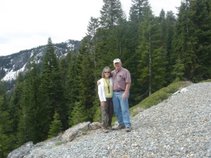
We took various and sundry roads (mostly dirt roads) headed south and then west; ultimately ending up in California. We did have to make a slight detour. We followed one main dirt road that was supposed to take us to Hurlong. We got all the way to the locked gate. The town was on the other side, but the gate was locked and we didn’t have the key. Someone thought they were cute and had left a sign on the gate identifying the other side as a “gated community”. I guess they wanted to keep the riff-raff like us out! So, back we went and found a main road over to 395 and headed north.

We had not gone far before we were stopped by road construction! We sat for a while before it was our turn to go. We eventually arrived at our destination, no thanks to the locked gate and Caltrans . We also gave ourselves a good “talking to” because we forgot to take a picture of the sign at the gate.

Once in California, we headed for Plumas National Forest . We picked up a few caches, but there were two that were noteworthy. The first one was the Otis Overlook Cache (GCGR3D). The elevation of the cache was 6400 and we had a beautiful view of Honey Lake Valley. At this cache we were in Plumas National Forest and, more specifically, in the Diamond Mountain Range. To and from the cache we passed meadows, wetlands, and several large ponds. We got some great pictures at the top. The views were incredible. We almost felt like we were back in Nevada as we were still rock climbing to get the cache.

The other cache was the “Meadow View Cache” (GCJPC5). According to the information about the cache, it is “Located near the 6000 foot level in rocky and somewhat steep terrain. A 4x4 vehicle with at least 12” of ground clearance and a good driver with moderate experience is mandatory.” We followed the owners instructions and located the access road. We looked at the “road” and looked again. It had not been used in some time! I think Cynthia referred to it as “a road less traveled”!

We followed our fearless leaders (Mike & Cynthia in GeoJeep) up what little of the road was still visible. I guess both our drivers (Mike & Larry) had what it takes to navigate this “road” and get us to the cache. When we reached the a point where we thought we were at the end, we still had a couple of hundred feet to walk--up hill. We made it! We found the cache and took more pictures. We took even more pictures on the way back as we now knew where most of the “fun” spots were. We can safely say that where once a road was, there is one again.


We actually ended this adventure back in Reno. After one last cache on the way out of Reno, we parted company. Cynthia and Mike (Geo-Jeeper) headed home in GeoJeep, while we headed for home in our Golden Retriever. We had a lot of fun, but we were ready to sit in our comfortable reclining chairs and to start enhancing our memories!

Sunday, May 6, 2007

On the Road to Gerlach


Today we (Larry, me, Cynthia & Mike) were headed for Gerlach, Nevada to attend an event honoring additional geocachers who have completed the Nevada Delorme Challenge. We started the day climbing rocks somewhere north off 395. The cache was a new one (Flying Fishes--GC12CNZ). We were able to get fairly close in our jeeps and then we climbed the rocks. We are getting quite proficient at climbing rocks. We keep practicing because we know that there will be another rock to climb as long as we continue caching in Nevada.

We stopped for lunch near a bunch of “tufa wheels” just off the Paiute Indian Reservation that surrounds Lake Pyramid. We were overlooking Lake Winnemucca--a dry lake bed. According to Wikipedia “The lake was formerly a shallow tule-filled lake and an important stop for migrating waterfowl. After the Derby Dam was built on the Truckee River in 1902 (the first project of the Reclamation Act), and Nevada State Route 447 (which blocked the slough connecting it to Pyramid Lake) was built, Winnemmucca Lake dried out and has been dry since the late 1930s.” The tufa formations here are fascinating. They are shaped like huge tires with a wheel hub in the middle. As we were leaving, a couple of cachers (LostinReno and Cookie&Faith) showed up. They were also on their way to Gerlach. We chatted briefly and then headed on up the road.

We took one more side trip before reaching Gerlach. On our way up into the hills, we were driving on a well maintained dirt road. At one point we were driving over and through bunches of Mormon crickets (yes, that is what they are called). These were fairly small. Mike and Larry have told us stories of the Mormon Crickets they have seen while on some of their off road jaunts. Those crickets were much larger--that’s their story, anyway.

Once in Gerlach, we met up with fellow geocachers. There were about 20 of us and we all had stories to tell over a marvelous dinner of Bruno’s famous raviolis at Bruno’s “Country Club”. The event was to honor those people who have recently completed the Nevada Delorme Challenge. It was appropriate to give them the same recognition we had been given when we completed the challenge.

After dinner, we all walked down the middle of the highway (yes, the highway) to get to a park. There is a webcam on the nearby Burning Man Building. You are supposed to capture your picture from the webcam website and post it on a cache page. Unfortunately, the webcam was not working, so we took a picture and posted that instead.

In addition to the non-functioning webcam we were attacked by a zillion gnats. They were not the type of gnats we are used to encountering. They are vicious attacking man/woman eating gnats. We were all being bitten as we posed for our picture. According to one of the locals, the gnats will be around until the temperature hits 90º three days in a row. Then the gnats disappear and the mosquitoes take their place. One reason not to move to Gerlach!

We ended the day with our usual geocaching glass of wine at Bruno’s Country Club Resort & Motel. The four of us discussed the joys of geocaching as well as how to best solve the problems of the world. How simple it would be if we were in charge!